You are here: Home > Network List > TA - USArray Transportable Network (new EarthScope stations) Stations List
> Station L04D Klamath Falls, OR, USA > Earthquake Result Viewer
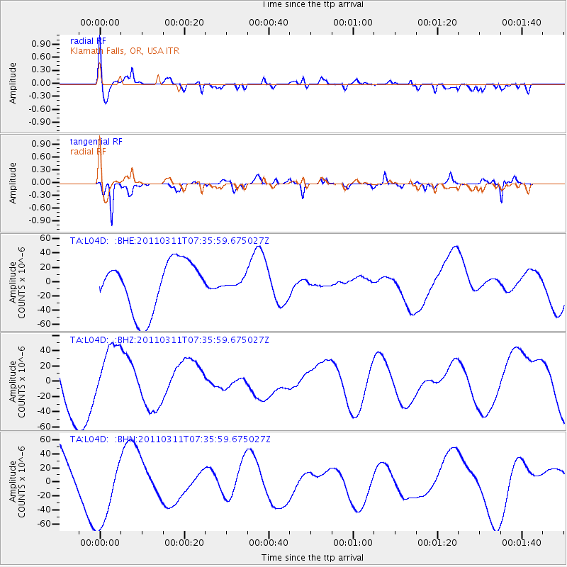
L04D Klamath Falls, OR, USA - Earthquake Result Viewer
*The percent match for this event was below the threshold and hence no stack was calculated.
| Earthquake location: |
Off East Coast Of Honshu, Japan |
| Earthquake latitude/longitude: |
37.9/144.5 |
| Earthquake time(UTC): |
2011/03/11 (070) 07:25:36 GMT |
| Earthquake Depth: |
40 km |
| Earthquake Magnitude: |
6.1 MB |
| Earthquake Catalog/Contributor: |
WHDF/NEIC |
|
| Network: |
TA USArray Transportable Network (new EarthScope stations) |
| Station: |
L04D Klamath Falls, OR, USA |
| Lat/Lon: |
42.22 N/122.30 W |
| Elevation: |
1437 m |
|
| Distance: |
67.8 deg |
| Az: |
53.219 deg |
| Baz: |
301.509 deg |
| Ray Param: |
$rayparam |
*The percent match for this event was below the threshold and hence was not used in the summary stack. |
|
| Radial Match: |
64.90292 % |
| Radial Bump: |
400 |
| Transverse Match: |
78.77856 % |
| Transverse Bump: |
291 |
| SOD ConfigId: |
356183 |
| Insert Time: |
2011-08-12 04:43:44.655 +0000 |
| GWidth: |
2.5 |
| Max Bumps: |
400 |
| Tol: |
0.001 |
|
Signal To Noise
| Channel | StoN | STA | LTA |
| TA:L04D: :BHZ:20110311T07:35:59.675027Z | 1.3805109 | 4.1586685E-5 | 3.0124125E-5 |
| TA:L04D: :BHN:20110311T07:35:59.675027Z | 1.9037296 | 5.4816064E-5 | 2.879404E-5 |
| TA:L04D: :BHE:20110311T07:35:59.675027Z | 0.17159042 | 5.964618E-6 | 3.476079E-5 |
| Arrivals |
| Ps | |
| PpPs | |
| PsPs/PpSs | |


