You are here: Home > Network List > TA - USArray Transportable Network (new EarthScope stations) Stations List
> Station D36A Goodland, MN, USA > Earthquake Result Viewer
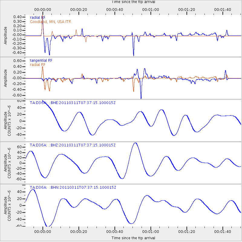
D36A Goodland, MN, USA - Earthquake Result Viewer
*The percent match for this event was below the threshold and hence no stack was calculated.
| Earthquake location: |
Off East Coast Of Honshu, Japan |
| Earthquake latitude/longitude: |
37.9/144.5 |
| Earthquake time(UTC): |
2011/03/11 (070) 07:25:36 GMT |
| Earthquake Depth: |
40 km |
| Earthquake Magnitude: |
6.1 MB |
| Earthquake Catalog/Contributor: |
WHDF/NEIC |
|
| Network: |
TA USArray Transportable Network (new EarthScope stations) |
| Station: |
D36A Goodland, MN, USA |
| Lat/Lon: |
47.18 N/93.16 W |
| Elevation: |
434 m |
|
| Distance: |
80.8 deg |
| Az: |
35.736 deg |
| Baz: |
317.393 deg |
| Ray Param: |
$rayparam |
*The percent match for this event was below the threshold and hence was not used in the summary stack. |
|
| Radial Match: |
76.01326 % |
| Radial Bump: |
400 |
| Transverse Match: |
25.019476 % |
| Transverse Bump: |
400 |
| SOD ConfigId: |
356183 |
| Insert Time: |
2011-08-12 04:50:23.453 +0000 |
| GWidth: |
2.5 |
| Max Bumps: |
400 |
| Tol: |
0.001 |
|
Signal To Noise
| Channel | StoN | STA | LTA |
| TA:D36A: :BHZ:20110311T07:37:15.100015Z | 1.7216936 | 4.5900102E-5 | 2.6659854E-5 |
| TA:D36A: :BHN:20110311T07:37:15.100015Z | 2.2568767 | 5.475784E-5 | 2.4262663E-5 |
| TA:D36A: :BHE:20110311T07:37:15.100015Z | 1.0162114 | 2.6644937E-5 | 2.6219877E-5 |
| Arrivals |
| Ps | |
| PpPs | |
| PsPs/PpSs | |


