You are here: Home > Network List > TA - USArray Transportable Network (new EarthScope stations) Stations List
> Station F35A Swanville, MN, USA > Earthquake Result Viewer
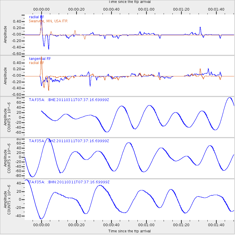
F35A Swanville, MN, USA - Earthquake Result Viewer

| Earthquake location: |
Off East Coast Of Honshu, Japan |
| Earthquake latitude/longitude: |
37.9/144.5 |
| Earthquake time(UTC): |
2011/03/11 (070) 07:25:36 GMT |
| Earthquake Depth: |
40 km |
| Earthquake Magnitude: |
6.1 MB |
| Earthquake Catalog/Contributor: |
WHDF/NEIC |
|
| Network: |
TA USArray Transportable Network (new EarthScope stations) |
| Station: |
F35A Swanville, MN, USA |
| Lat/Lon: |
45.86 N/94.57 W |
| Elevation: |
376 m |
|
| Distance: |
81.1 deg |
| Az: |
37.367 deg |
| Baz: |
316.63 deg |
| Ray Param: |
0.047738694 |
| Estimated Moho Depth: |
32.5 km |
| Estimated Crust Vp/Vs: |
1.63 |
| Assumed Crust Vp: |
6.571 km/s |
| Estimated Crust Vs: |
4.025 km/s |
| Estimated Crust Poisson's Ratio: |
0.20 |
|
| Radial Match: |
80.053986 % |
| Radial Bump: |
400 |
| Transverse Match: |
69.60167 % |
| Transverse Bump: |
400 |
| SOD ConfigId: |
356183 |
| Insert Time: |
2011-08-12 04:51:24.010 +0000 |
| GWidth: |
2.5 |
| Max Bumps: |
400 |
| Tol: |
0.001 |
|
Signal To Noise
| Channel | StoN | STA | LTA |
| TA:F35A: :BHZ:20110311T07:37:16.69999Z | 1.1556214 | 6.239213E-5 | 5.3990112E-5 |
| TA:F35A: :BHN:20110311T07:37:16.69999Z | 1.0425974 | 3.959822E-5 | 3.7980353E-5 |
| TA:F35A: :BHE:20110311T07:37:16.69999Z | 1.8318503 | 1.7295988E-5 | 9.441813E-6 |
| Arrivals |
| Ps | 3.2 SECOND |
| PpPs | 13 SECOND |
| PsPs/PpSs | 16 SECOND |


