You are here: Home > Network List > IW - Intermountain West Stations List
> Station MOOW Moose Ponds, Wyoming, USA > Earthquake Result Viewer
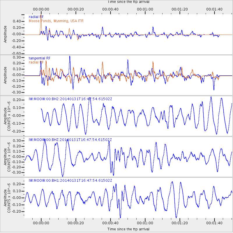
MOOW Moose Ponds, Wyoming, USA - Earthquake Result Viewer
*The percent match for this event was below the threshold and hence no stack was calculated.
| Earthquake location: |
Near East Coast Of Kamchatka |
| Earthquake latitude/longitude: |
54.6/159.7 |
| Earthquake time(UTC): |
2014/01/31 (031) 16:39:06 GMT |
| Earthquake Depth: |
168 km |
| Earthquake Magnitude: |
5.5 MW |
| Earthquake Catalog/Contributor: |
ISC/ISC |
|
| Network: |
IW Intermountain West |
| Station: |
MOOW Moose Ponds, Wyoming, USA |
| Lat/Lon: |
43.75 N/110.74 W |
| Elevation: |
2128 m |
|
| Distance: |
55.7 deg |
| Az: |
61.333 deg |
| Baz: |
315.252 deg |
| Ray Param: |
$rayparam |
*The percent match for this event was below the threshold and hence was not used in the summary stack. |
|
| Radial Match: |
42.621334 % |
| Radial Bump: |
400 |
| Transverse Match: |
64.38387 % |
| Transverse Bump: |
400 |
| SOD ConfigId: |
3390531 |
| Insert Time: |
2019-04-10 04:21:41.006 +0000 |
| GWidth: |
2.5 |
| Max Bumps: |
400 |
| Tol: |
0.001 |
|
Signal To Noise
| Channel | StoN | STA | LTA |
| IW:MOOW:00:BHZ:20140131T16:47:54.61502Z | 2.2535074 | 2.0390367E-7 | 9.048281E-8 |
| IW:MOOW:00:BH1:20140131T16:47:54.61502Z | 1.2618692 | 8.239241E-8 | 6.529393E-8 |
| IW:MOOW:00:BH2:20140131T16:47:54.61502Z | 0.7418955 | 7.0073526E-8 | 9.445201E-8 |
| Arrivals |
| Ps | |
| PpPs | |
| PsPs/PpSs | |


