You are here: Home > Network List > US - United States National Seismic Network Stations List
> Station CBKS Cedar Bluff, Kansas, USA > Earthquake Result Viewer
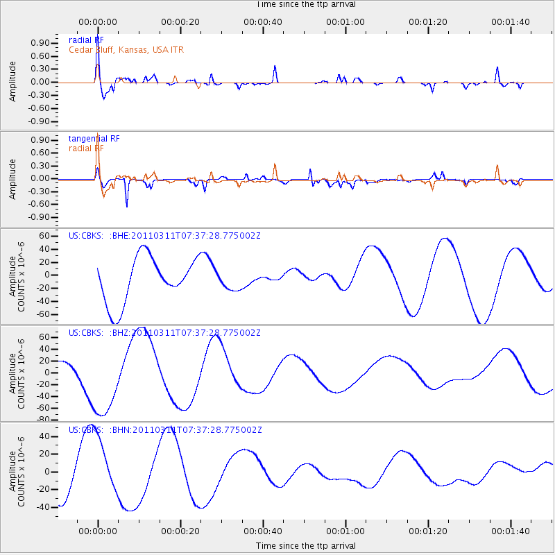
CBKS Cedar Bluff, Kansas, USA - Earthquake Result Viewer
*The percent match for this event was below the threshold and hence no stack was calculated.
| Earthquake location: |
Off East Coast Of Honshu, Japan |
| Earthquake latitude/longitude: |
37.9/144.5 |
| Earthquake time(UTC): |
2011/03/11 (070) 07:25:36 GMT |
| Earthquake Depth: |
40 km |
| Earthquake Magnitude: |
6.1 MB |
| Earthquake Catalog/Contributor: |
WHDF/NEIC |
|
| Network: |
US United States National Seismic Network |
| Station: |
CBKS Cedar Bluff, Kansas, USA |
| Lat/Lon: |
38.81 N/99.74 W |
| Elevation: |
677 m |
|
| Distance: |
83.5 deg |
| Az: |
45.102 deg |
| Baz: |
314.196 deg |
| Ray Param: |
$rayparam |
*The percent match for this event was below the threshold and hence was not used in the summary stack. |
|
| Radial Match: |
68.913216 % |
| Radial Bump: |
382 |
| Transverse Match: |
72.26815 % |
| Transverse Bump: |
358 |
| SOD ConfigId: |
356183 |
| Insert Time: |
2011-08-12 05:05:30.891 +0000 |
| GWidth: |
2.5 |
| Max Bumps: |
400 |
| Tol: |
0.001 |
|
Signal To Noise
| Channel | StoN | STA | LTA |
| US:CBKS: :BHZ:20110311T07:37:28.775002Z | 3.5954876 | 6.7383655E-5 | 1.8741173E-5 |
| US:CBKS: :BHN:20110311T07:37:28.775002Z | 1.7170719 | 3.4624074E-5 | 2.0164603E-5 |
| US:CBKS: :BHE:20110311T07:37:28.775002Z | 0.39038795 | 1.3578959E-5 | 3.4783243E-5 |
| Arrivals |
| Ps | |
| PpPs | |
| PsPs/PpSs | |


