You are here: Home > Network List > TA - USArray Transportable Network (new EarthScope stations) Stations List
> Station G59A Clarenceville, QC, USA > Earthquake Result Viewer
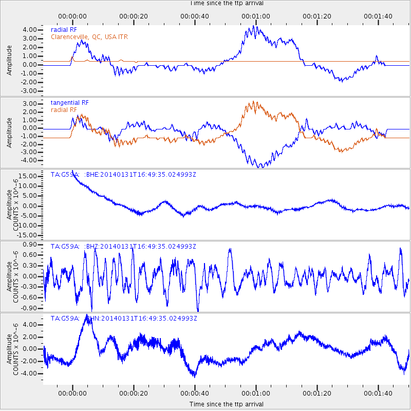
G59A Clarenceville, QC, USA - Earthquake Result Viewer
*The percent match for this event was below the threshold and hence no stack was calculated.
| Earthquake location: |
Near East Coast Of Kamchatka |
| Earthquake latitude/longitude: |
54.6/159.7 |
| Earthquake time(UTC): |
2014/01/31 (031) 16:39:06 GMT |
| Earthquake Depth: |
168 km |
| Earthquake Magnitude: |
5.5 MW |
| Earthquake Catalog/Contributor: |
ISC/ISC |
|
| Network: |
TA USArray Transportable Network (new EarthScope stations) |
| Station: |
G59A Clarenceville, QC, USA |
| Lat/Lon: |
45.08 N/73.18 W |
| Elevation: |
36 m |
|
| Distance: |
71.0 deg |
| Az: |
36.682 deg |
| Baz: |
330.642 deg |
| Ray Param: |
$rayparam |
*The percent match for this event was below the threshold and hence was not used in the summary stack. |
|
| Radial Match: |
48.68883 % |
| Radial Bump: |
400 |
| Transverse Match: |
23.027832 % |
| Transverse Bump: |
400 |
| SOD ConfigId: |
3390531 |
| Insert Time: |
2019-04-10 04:24:00.044 +0000 |
| GWidth: |
2.5 |
| Max Bumps: |
400 |
| Tol: |
0.001 |
|
Signal To Noise
| Channel | StoN | STA | LTA |
| TA:G59A: :BHZ:20140131T16:49:35.024993Z | 1.6376289 | 4.156254E-7 | 2.5379708E-7 |
| TA:G59A: :BHN:20140131T16:49:35.024993Z | 2.2743328 | 2.9794014E-6 | 1.3100112E-6 |
| TA:G59A: :BHE:20140131T16:49:35.024993Z | 0.7068244 | 4.0297236E-6 | 5.701166E-6 |
| Arrivals |
| Ps | |
| PpPs | |
| PsPs/PpSs | |


