You are here: Home > Network List > TA - USArray Transportable Network (new EarthScope stations) Stations List
> Station J04D Umpqua National Forest, Toketee, OR, USA > Earthquake Result Viewer
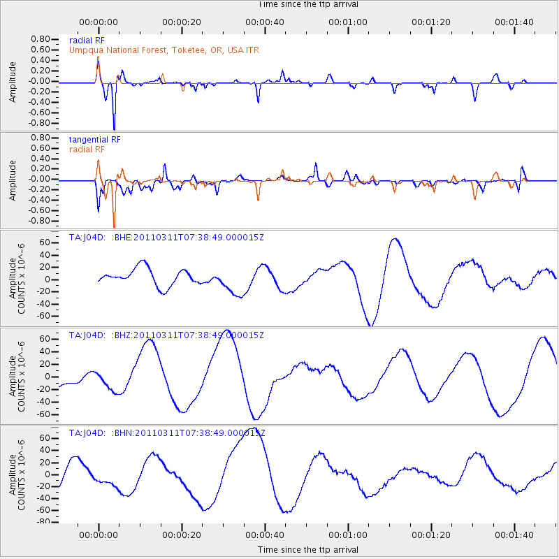
J04D Umpqua National Forest, Toketee, OR, USA - Earthquake Result Viewer
*The percent match for this event was below the threshold and hence no stack was calculated.
| Earthquake location: |
Near East Coast Of Honshu, Japan |
| Earthquake latitude/longitude: |
36.8/141.8 |
| Earthquake time(UTC): |
2011/03/11 (070) 07:28:12 GMT |
| Earthquake Depth: |
28 km |
| Earthquake Magnitude: |
6.1 MB |
| Earthquake Catalog/Contributor: |
WHDF/NEIC |
|
| Network: |
TA USArray Transportable Network (new EarthScope stations) |
| Station: |
J04D Umpqua National Forest, Toketee, OR, USA |
| Lat/Lon: |
43.24 N/122.11 W |
| Elevation: |
1948 m |
|
| Distance: |
69.8 deg |
| Az: |
50.745 deg |
| Baz: |
301.761 deg |
| Ray Param: |
$rayparam |
*The percent match for this event was below the threshold and hence was not used in the summary stack. |
|
| Radial Match: |
80.48194 % |
| Radial Bump: |
257 |
| Transverse Match: |
81.68793 % |
| Transverse Bump: |
400 |
| SOD ConfigId: |
356183 |
| Insert Time: |
2011-08-12 06:23:22.906 +0000 |
| GWidth: |
2.5 |
| Max Bumps: |
400 |
| Tol: |
0.001 |
|
Signal To Noise
| Channel | StoN | STA | LTA |
| TA:J04D: :BHZ:20110311T07:38:49.000015Z | 1.0107732 | 1.4595789E-5 | 1.4440223E-5 |
| TA:J04D: :BHN:20110311T07:38:49.000015Z | 0.9572752 | 1.768487E-5 | 1.8474175E-5 |
| TA:J04D: :BHE:20110311T07:38:49.000015Z | 1.7916863 | 2.4380248E-5 | 1.3607431E-5 |
| Arrivals |
| Ps | |
| PpPs | |
| PsPs/PpSs | |


