You are here: Home > Network List > TA - USArray Transportable Network (new EarthScope stations) Stations List
> Station 536A Bastrop, TX, USA > Earthquake Result Viewer
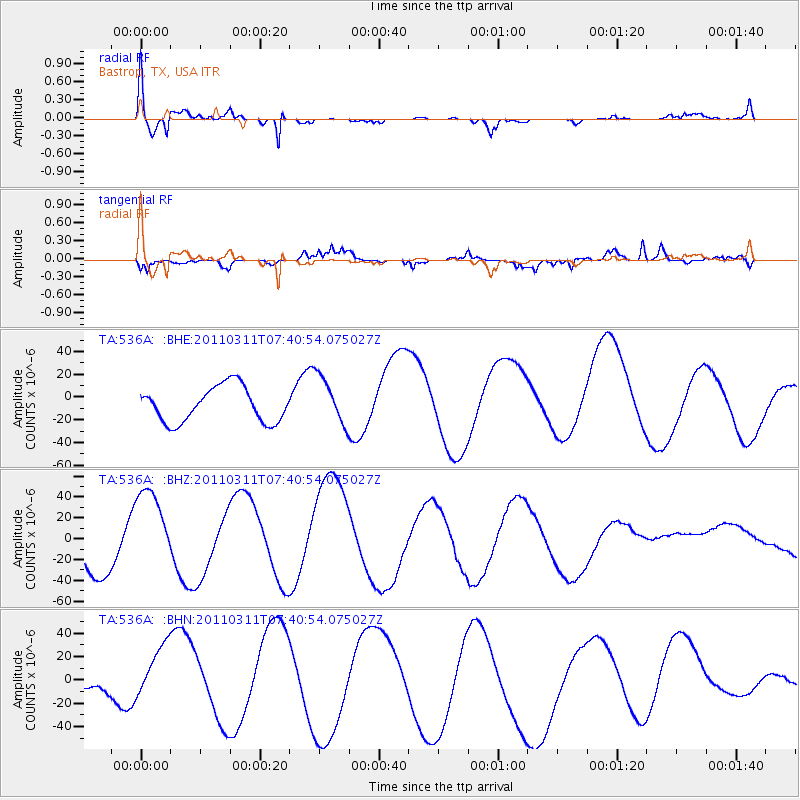
536A Bastrop, TX, USA - Earthquake Result Viewer
*The percent match for this event was below the threshold and hence no stack was calculated.
| Earthquake location: |
Near East Coast Of Honshu, Japan |
| Earthquake latitude/longitude: |
36.8/141.8 |
| Earthquake time(UTC): |
2011/03/11 (070) 07:28:12 GMT |
| Earthquake Depth: |
28 km |
| Earthquake Magnitude: |
6.1 MB |
| Earthquake Catalog/Contributor: |
WHDF/NEIC |
|
| Network: |
TA USArray Transportable Network (new EarthScope stations) |
| Station: |
536A Bastrop, TX, USA |
| Lat/Lon: |
30.08 N/97.07 W |
| Elevation: |
115 m |
|
| Distance: |
93.5 deg |
| Az: |
48.036 deg |
| Baz: |
316.503 deg |
| Ray Param: |
$rayparam |
*The percent match for this event was below the threshold and hence was not used in the summary stack. |
|
| Radial Match: |
66.97488 % |
| Radial Bump: |
372 |
| Transverse Match: |
56.529537 % |
| Transverse Bump: |
400 |
| SOD ConfigId: |
356183 |
| Insert Time: |
2011-08-12 06:29:13.776 +0000 |
| GWidth: |
2.5 |
| Max Bumps: |
400 |
| Tol: |
0.001 |
|
Signal To Noise
| Channel | StoN | STA | LTA |
| TA:536A: :BHZ:20110311T07:40:54.075027Z | 1.2436444 | 4.2275777E-5 | 3.399346E-5 |
| TA:536A: :BHN:20110311T07:40:54.075027Z | 1.3088409 | 3.2410266E-5 | 2.4762572E-5 |
| TA:536A: :BHE:20110311T07:40:54.075027Z | 1.3696624 | 2.1068623E-5 | 1.5382348E-5 |
| Arrivals |
| Ps | |
| PpPs | |
| PsPs/PpSs | |


