You are here: Home > Network List > TA - USArray Transportable Network (new EarthScope stations) Stations List
> Station V37A Hulbert, OK, USA > Earthquake Result Viewer
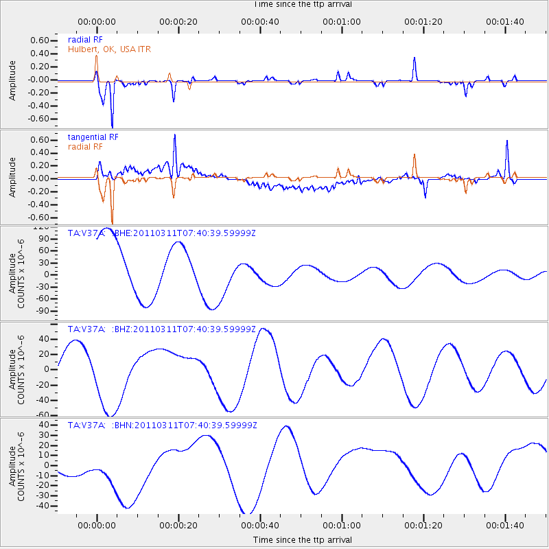
V37A Hulbert, OK, USA - Earthquake Result Viewer
*The percent match for this event was below the threshold and hence no stack was calculated.
| Earthquake location: |
Near East Coast Of Honshu, Japan |
| Earthquake latitude/longitude: |
36.8/141.8 |
| Earthquake time(UTC): |
2011/03/11 (070) 07:28:12 GMT |
| Earthquake Depth: |
28 km |
| Earthquake Magnitude: |
6.1 MB |
| Earthquake Catalog/Contributor: |
WHDF/NEIC |
|
| Network: |
TA USArray Transportable Network (new EarthScope stations) |
| Station: |
V37A Hulbert, OK, USA |
| Lat/Lon: |
35.88 N/95.14 W |
| Elevation: |
219 m |
|
| Distance: |
90.4 deg |
| Az: |
42.907 deg |
| Baz: |
317.723 deg |
| Ray Param: |
$rayparam |
*The percent match for this event was below the threshold and hence was not used in the summary stack. |
|
| Radial Match: |
85.54462 % |
| Radial Bump: |
259 |
| Transverse Match: |
50.323647 % |
| Transverse Bump: |
400 |
| SOD ConfigId: |
356183 |
| Insert Time: |
2011-08-12 06:36:38.982 +0000 |
| GWidth: |
2.5 |
| Max Bumps: |
400 |
| Tol: |
0.001 |
|
Signal To Noise
| Channel | StoN | STA | LTA |
| TA:V37A: :BHZ:20110311T07:40:39.59999Z | 1.7417048 | 4.8014535E-5 | 2.756755E-5 |
| TA:V37A: :BHN:20110311T07:40:39.59999Z | 1.2317102 | 3.0784493E-5 | 2.4993293E-5 |
| TA:V37A: :BHE:20110311T07:40:39.59999Z | 1.0530595 | 6.793352E-5 | 6.451062E-5 |
| Arrivals |
| Ps | |
| PpPs | |
| PsPs/PpSs | |


