You are here: Home > Network List > TA - USArray Transportable Network (new EarthScope stations) Stations List
> Station T35A Sooner Cattle Company, Foraker, OK, USA > Earthquake Result Viewer
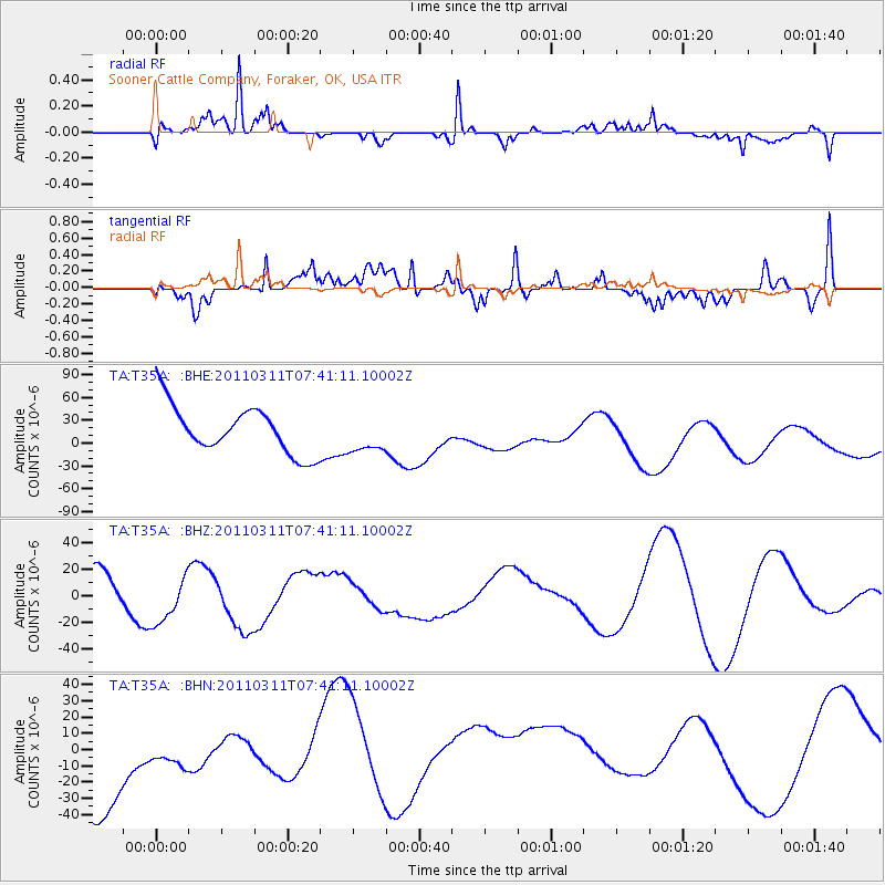
T35A Sooner Cattle Company, Foraker, OK, USA - Earthquake Result Viewer
*The percent match for this event was below the threshold and hence no stack was calculated.
| Earthquake location: |
Near East Coast Of Honshu, Japan |
| Earthquake latitude/longitude: |
39.0/142.3 |
| Earthquake time(UTC): |
2011/03/11 (070) 07:29:01 GMT |
| Earthquake Depth: |
45 km |
| Earthquake Magnitude: |
6.3 MB |
| Earthquake Catalog/Contributor: |
WHDF/NEIC |
|
| Network: |
TA USArray Transportable Network (new EarthScope stations) |
| Station: |
T35A Sooner Cattle Company, Foraker, OK, USA |
| Lat/Lon: |
36.92 N/96.51 W |
| Elevation: |
401 m |
|
| Distance: |
87.0 deg |
| Az: |
43.386 deg |
| Baz: |
318.121 deg |
| Ray Param: |
$rayparam |
*The percent match for this event was below the threshold and hence was not used in the summary stack. |
|
| Radial Match: |
54.79423 % |
| Radial Bump: |
300 |
| Transverse Match: |
61.757484 % |
| Transverse Bump: |
394 |
| SOD ConfigId: |
356183 |
| Insert Time: |
2011-08-12 08:19:07.614 +0000 |
| GWidth: |
2.5 |
| Max Bumps: |
400 |
| Tol: |
0.001 |
|
Signal To Noise
| Channel | StoN | STA | LTA |
| TA:T35A: :BHZ:20110311T07:41:11.10002Z | 0.90882105 | 1.9651286E-5 | 2.1622833E-5 |
| TA:T35A: :BHN:20110311T07:41:11.10002Z | 0.6252183 | 2.3427358E-5 | 3.7470687E-5 |
| TA:T35A: :BHE:20110311T07:41:11.10002Z | 0.7915035 | 2.4666808E-5 | 3.1164498E-5 |
| Arrivals |
| Ps | |
| PpPs | |
| PsPs/PpSs | |


