You are here: Home > Network List > TA - USArray Transportable Network (new EarthScope stations) Stations List
> Station M35A Neola, IA, USA > Earthquake Result Viewer
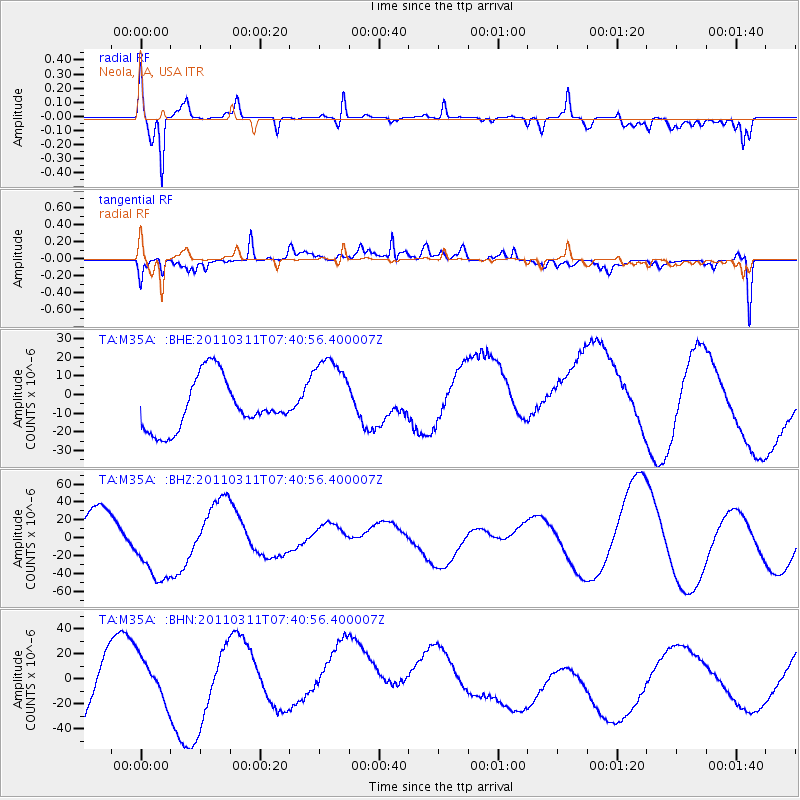
M35A Neola, IA, USA - Earthquake Result Viewer
*The percent match for this event was below the threshold and hence no stack was calculated.
| Earthquake location: |
Near East Coast Of Honshu, Japan |
| Earthquake latitude/longitude: |
39.0/142.3 |
| Earthquake time(UTC): |
2011/03/11 (070) 07:29:01 GMT |
| Earthquake Depth: |
45 km |
| Earthquake Magnitude: |
6.3 MB |
| Earthquake Catalog/Contributor: |
WHDF/NEIC |
|
| Network: |
TA USArray Transportable Network (new EarthScope stations) |
| Station: |
M35A Neola, IA, USA |
| Lat/Lon: |
41.47 N/95.69 W |
| Elevation: |
363 m |
|
| Distance: |
84.0 deg |
| Az: |
39.875 deg |
| Baz: |
318.361 deg |
| Ray Param: |
$rayparam |
*The percent match for this event was below the threshold and hence was not used in the summary stack. |
|
| Radial Match: |
57.05166 % |
| Radial Bump: |
344 |
| Transverse Match: |
62.065178 % |
| Transverse Bump: |
400 |
| SOD ConfigId: |
356183 |
| Insert Time: |
2011-08-12 08:23:01.108 +0000 |
| GWidth: |
2.5 |
| Max Bumps: |
400 |
| Tol: |
0.001 |
|
Signal To Noise
| Channel | StoN | STA | LTA |
| TA:M35A: :BHZ:20110311T07:40:56.400007Z | 1.890341 | 4.1929936E-5 | 2.2181148E-5 |
| TA:M35A: :BHN:20110311T07:40:56.400007Z | 1.0129054 | 1.8851491E-5 | 1.8611307E-5 |
| TA:M35A: :BHE:20110311T07:40:56.400007Z | 1.6029389 | 2.1927712E-5 | 1.3679693E-5 |
| Arrivals |
| Ps | |
| PpPs | |
| PsPs/PpSs | |


