You are here: Home > Network List > TA - USArray Transportable Network (new EarthScope stations) Stations List
> Station T35A Sooner Cattle Company, Foraker, OK, USA > Earthquake Result Viewer
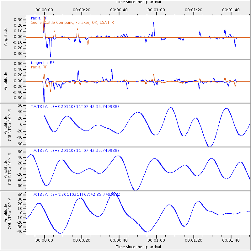
T35A Sooner Cattle Company, Foraker, OK, USA - Earthquake Result Viewer
*The percent match for this event was below the threshold and hence no stack was calculated.
| Earthquake location: |
Near East Coast Of Honshu, Japan |
| Earthquake latitude/longitude: |
37.4/141.2 |
| Earthquake time(UTC): |
2011/03/11 (070) 07:30:18 GMT |
| Earthquake Depth: |
49 km |
| Earthquake Magnitude: |
6.0 MB |
| Earthquake Catalog/Contributor: |
WHDF/NEIC |
|
| Network: |
TA USArray Transportable Network (new EarthScope stations) |
| Station: |
T35A Sooner Cattle Company, Foraker, OK, USA |
| Lat/Lon: |
36.92 N/96.51 W |
| Elevation: |
401 m |
|
| Distance: |
88.8 deg |
| Az: |
42.659 deg |
| Baz: |
317.703 deg |
| Ray Param: |
$rayparam |
*The percent match for this event was below the threshold and hence was not used in the summary stack. |
|
| Radial Match: |
71.693016 % |
| Radial Bump: |
332 |
| Transverse Match: |
77.803825 % |
| Transverse Bump: |
262 |
| SOD ConfigId: |
356183 |
| Insert Time: |
2011-08-12 10:01:32.461 +0000 |
| GWidth: |
2.5 |
| Max Bumps: |
400 |
| Tol: |
0.001 |
|
Signal To Noise
| Channel | StoN | STA | LTA |
| TA:T35A: :BHZ:20110311T07:42:35.749988Z | 2.1133835 | 5.1762592E-5 | 2.4492758E-5 |
| TA:T35A: :BHN:20110311T07:42:35.749988Z | 1.8186071 | 1.673015E-5 | 9.199431E-6 |
| TA:T35A: :BHE:20110311T07:42:35.749988Z | 0.45083833 | 7.392818E-6 | 1.6397937E-5 |
| Arrivals |
| Ps | |
| PpPs | |
| PsPs/PpSs | |


