You are here: Home > Network List > TA - USArray Transportable Network (new EarthScope stations) Stations List
> Station I34A Hadley, MN, USA > Earthquake Result Viewer
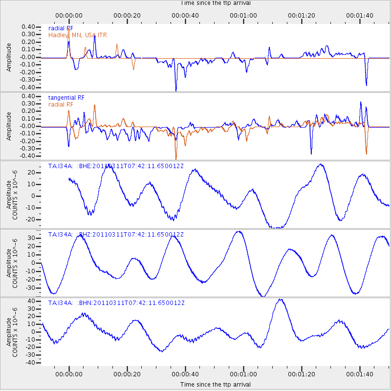
I34A Hadley, MN, USA - Earthquake Result Viewer
*The percent match for this event was below the threshold and hence no stack was calculated.
| Earthquake location: |
Near East Coast Of Honshu, Japan |
| Earthquake latitude/longitude: |
37.4/141.2 |
| Earthquake time(UTC): |
2011/03/11 (070) 07:30:18 GMT |
| Earthquake Depth: |
49 km |
| Earthquake Magnitude: |
6.0 MB |
| Earthquake Catalog/Contributor: |
WHDF/NEIC |
|
| Network: |
TA USArray Transportable Network (new EarthScope stations) |
| Station: |
I34A Hadley, MN, USA |
| Lat/Lon: |
44.04 N/95.86 W |
| Elevation: |
509 m |
|
| Distance: |
83.8 deg |
| Az: |
37.498 deg |
| Baz: |
317.793 deg |
| Ray Param: |
$rayparam |
*The percent match for this event was below the threshold and hence was not used in the summary stack. |
|
| Radial Match: |
81.564384 % |
| Radial Bump: |
400 |
| Transverse Match: |
55.238632 % |
| Transverse Bump: |
400 |
| SOD ConfigId: |
356183 |
| Insert Time: |
2011-08-12 10:06:51.734 +0000 |
| GWidth: |
2.5 |
| Max Bumps: |
400 |
| Tol: |
0.001 |
|
Signal To Noise
| Channel | StoN | STA | LTA |
| TA:I34A: :BHZ:20110311T07:42:11.650012Z | 1.4023832 | 2.5388466E-5 | 1.8103801E-5 |
| TA:I34A: :BHN:20110311T07:42:11.650012Z | 1.1812353 | 1.9003108E-5 | 1.6087488E-5 |
| TA:I34A: :BHE:20110311T07:42:11.650012Z | 1.1359646 | 1.3846185E-5 | 1.21889225E-5 |
| Arrivals |
| Ps | |
| PpPs | |
| PsPs/PpSs | |


