You are here: Home > Network List > TA - USArray Transportable Network (new EarthScope stations) Stations List
> Station 240A Hunter Patterson, Mansfield, LA, USA > Earthquake Result Viewer
240A Hunter Patterson, Mansfield, LA, USA - Earthquake Result Viewer

| Earthquake location: |
Near East Coast Of Honshu, Japan |
| Earthquake latitude/longitude: |
37.4/141.2 |
| Earthquake time(UTC): |
2011/03/11 (070) 07:30:18 GMT |
| Earthquake Depth: |
49 km |
| Earthquake Magnitude: |
6.0 MB |
| Earthquake Catalog/Contributor: |
WHDF/NEIC |
|
| Network: |
TA USArray Transportable Network (new EarthScope stations) |
| Station: |
240A Hunter Patterson, Mansfield, LA, USA |
| Lat/Lon: |
32.04 N/93.76 W |
| Elevation: |
119 m |
|
| Distance: |
93.9 deg |
| Az: |
44.185 deg |
| Baz: |
319.218 deg |
| Ray Param: |
0.041137435 |
| Estimated Moho Depth: |
63.5 km |
| Estimated Crust Vp/Vs: |
1.76 |
| Assumed Crust Vp: |
6.245 km/s |
| Estimated Crust Vs: |
3.543 km/s |
| Estimated Crust Poisson's Ratio: |
0.26 |
|
| Radial Match: |
85.97946 % |
| Radial Bump: |
400 |
| Transverse Match: |
61.407574 % |
| Transverse Bump: |
400 |
| SOD ConfigId: |
356183 |
| Insert Time: |
2011-08-12 10:22:02.052 +0000 |
| GWidth: |
2.5 |
| Max Bumps: |
400 |
| Tol: |
0.001 |
|
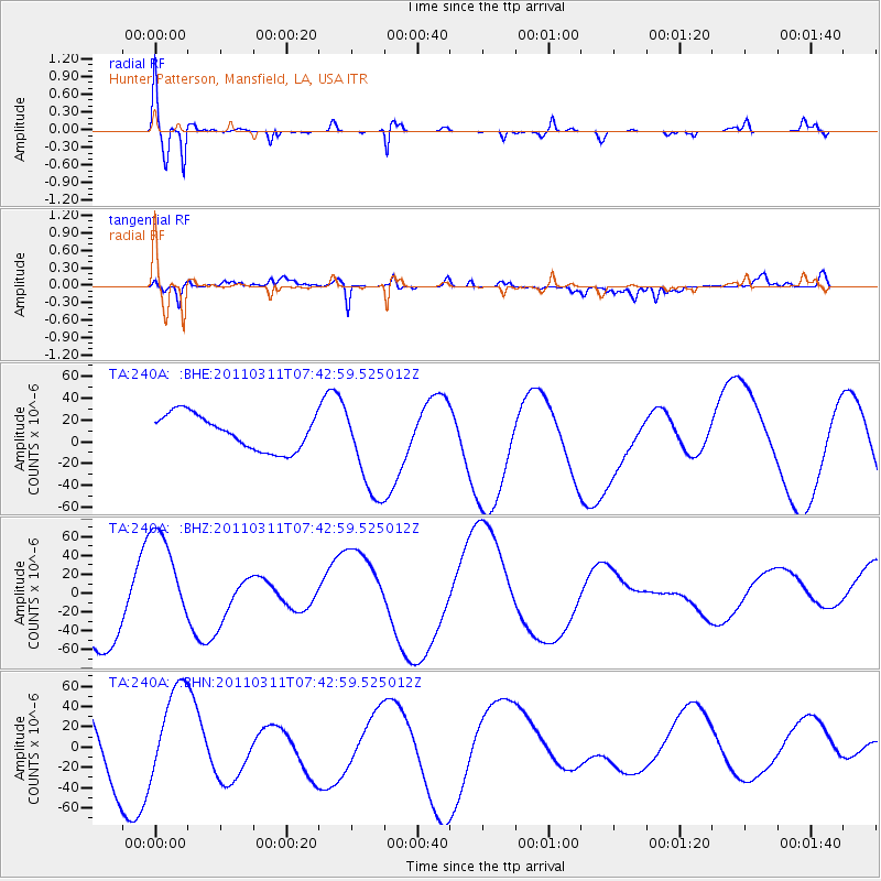
Signal To Noise
| Channel | StoN | STA | LTA |
| TA:240A: :BHZ:20110311T07:42:59.525012Z | 1.499028 | 5.621817E-5 | 3.7503083E-5 |
| TA:240A: :BHN:20110311T07:42:59.525012Z | 1.0149477 | 3.974675E-5 | 3.916138E-5 |
| TA:240A: :BHE:20110311T07:42:59.525012Z | 2.752207 | 4.4081382E-5 | 1.6016738E-5 |
| Arrivals |
| Ps | 7.9 SECOND |
| PpPs | 28 SECOND |
| PsPs/PpSs | 35 SECOND |


