You are here: Home > Network List > TA - USArray Transportable Network (new EarthScope stations) Stations List
> Station J01D Myrtle Point, OR, USA > Earthquake Result Viewer
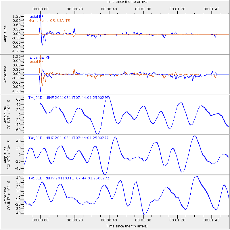
J01D Myrtle Point, OR, USA - Earthquake Result Viewer
*The percent match for this event was below the threshold and hence no stack was calculated.
| Earthquake location: |
Off East Coast Of Honshu, Japan |
| Earthquake latitude/longitude: |
36.3/142.7 |
| Earthquake time(UTC): |
2011/03/11 (070) 07:33:33 GMT |
| Earthquake Depth: |
35 km |
| Earthquake Magnitude: |
5.7 MB |
| Earthquake Catalog/Contributor: |
WHDF/NEIC |
|
| Network: |
TA USArray Transportable Network (new EarthScope stations) |
| Station: |
J01D Myrtle Point, OR, USA |
| Lat/Lon: |
43.16 N/123.93 W |
| Elevation: |
131 m |
|
| Distance: |
68.4 deg |
| Az: |
51.755 deg |
| Baz: |
299.911 deg |
| Ray Param: |
$rayparam |
*The percent match for this event was below the threshold and hence was not used in the summary stack. |
|
| Radial Match: |
43.89974 % |
| Radial Bump: |
350 |
| Transverse Match: |
44.728466 % |
| Transverse Bump: |
366 |
| SOD ConfigId: |
356183 |
| Insert Time: |
2011-08-12 12:33:45.364 +0000 |
| GWidth: |
2.5 |
| Max Bumps: |
400 |
| Tol: |
0.001 |
|
Signal To Noise
| Channel | StoN | STA | LTA |
| TA:J01D: :BHZ:20110311T07:44:01.250027Z | 0.8930764 | 1.5059268E-5 | 1.686224E-5 |
| TA:J01D: :BHN:20110311T07:44:01.250027Z | 0.79909986 | 2.2016184E-5 | 2.7551228E-5 |
| TA:J01D: :BHE:20110311T07:44:01.250027Z | 3.305369 | 6.7510584E-5 | 2.0424523E-5 |
| Arrivals |
| Ps | |
| PpPs | |
| PsPs/PpSs | |


