You are here: Home > Network List > TA - USArray Transportable Network (new EarthScope stations) Stations List
> Station E25A Miller Ranch, Amidon, ND, USA > Earthquake Result Viewer
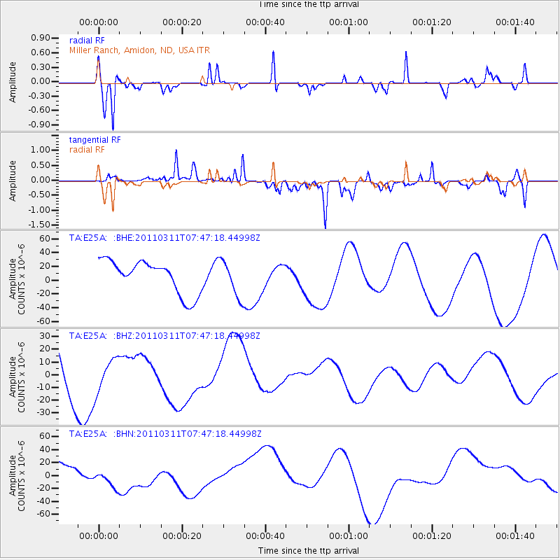
E25A Miller Ranch, Amidon, ND, USA - Earthquake Result Viewer
*The percent match for this event was below the threshold and hence no stack was calculated.
| Earthquake location: |
Off East Coast Of Honshu, Japan |
| Earthquake latitude/longitude: |
36.9/142.3 |
| Earthquake time(UTC): |
2011/03/11 (070) 07:35:52 GMT |
| Earthquake Depth: |
22 km |
| Earthquake Magnitude: |
5.7 MB |
| Earthquake Catalog/Contributor: |
WHDF/NEIC |
|
| Network: |
TA USArray Transportable Network (new EarthScope stations) |
| Station: |
E25A Miller Ranch, Amidon, ND, USA |
| Lat/Lon: |
46.50 N/103.40 W |
| Elevation: |
885 m |
|
| Distance: |
78.2 deg |
| Az: |
40.038 deg |
| Baz: |
311.746 deg |
| Ray Param: |
$rayparam |
*The percent match for this event was below the threshold and hence was not used in the summary stack. |
|
| Radial Match: |
78.578606 % |
| Radial Bump: |
376 |
| Transverse Match: |
63.654995 % |
| Transverse Bump: |
400 |
| SOD ConfigId: |
356183 |
| Insert Time: |
2011-08-12 13:46:59.646 +0000 |
| GWidth: |
2.5 |
| Max Bumps: |
400 |
| Tol: |
0.001 |
|
Signal To Noise
| Channel | StoN | STA | LTA |
| TA:E25A: :BHZ:20110311T07:47:18.44998Z | 0.5832992 | 1.215348E-5 | 2.0835756E-5 |
| TA:E25A: :BHN:20110311T07:47:18.44998Z | 0.9352803 | 2.6404981E-5 | 2.8232158E-5 |
| TA:E25A: :BHE:20110311T07:47:18.44998Z | 1.146009 | 2.7168213E-5 | 2.3706807E-5 |
| Arrivals |
| Ps | |
| PpPs | |
| PsPs/PpSs | |


