You are here: Home > Network List > TA - USArray Transportable Network (new EarthScope stations) Stations List
> Station X58A Rowland, NC, USA > Earthquake Result Viewer
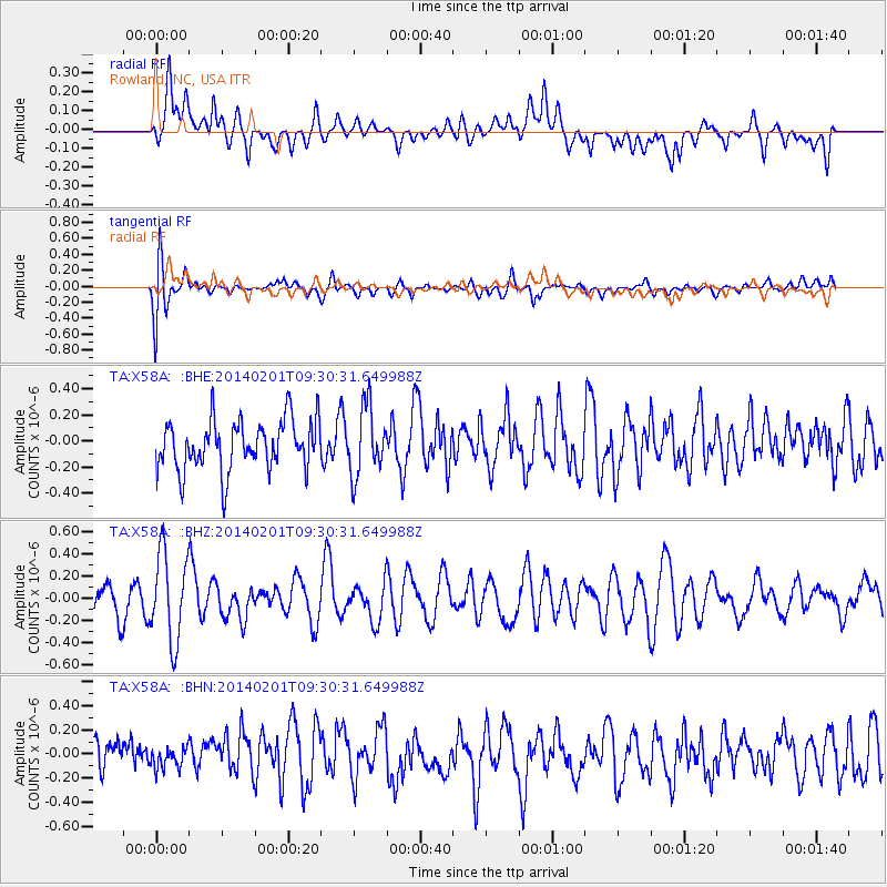
X58A Rowland, NC, USA - Earthquake Result Viewer
*The percent match for this event was below the threshold and hence no stack was calculated.
| Earthquake location: |
Southern East Pacific Rise |
| Earthquake latitude/longitude: |
-55.1/-126.6 |
| Earthquake time(UTC): |
2014/02/01 (032) 09:17:26 GMT |
| Earthquake Depth: |
10 km |
| Earthquake Magnitude: |
5.2 MW |
| Earthquake Catalog/Contributor: |
ISC/ISC |
|
| Network: |
TA USArray Transportable Network (new EarthScope stations) |
| Station: |
X58A Rowland, NC, USA |
| Lat/Lon: |
34.55 N/79.34 W |
| Elevation: |
45 m |
|
| Distance: |
98.1 deg |
| Az: |
37.754 deg |
| Baz: |
205.221 deg |
| Ray Param: |
$rayparam |
*The percent match for this event was below the threshold and hence was not used in the summary stack. |
|
| Radial Match: |
40.254257 % |
| Radial Bump: |
400 |
| Transverse Match: |
66.37989 % |
| Transverse Bump: |
400 |
| SOD ConfigId: |
3390531 |
| Insert Time: |
2019-04-10 04:34:21.484 +0000 |
| GWidth: |
2.5 |
| Max Bumps: |
400 |
| Tol: |
0.001 |
|
Signal To Noise
| Channel | StoN | STA | LTA |
| TA:X58A: :BHZ:20140201T09:30:31.649988Z | 1.5797137 | 3.993966E-7 | 2.5282847E-7 |
| TA:X58A: :BHN:20140201T09:30:31.649988Z | 0.37848747 | 8.413163E-8 | 2.2228379E-7 |
| TA:X58A: :BHE:20140201T09:30:31.649988Z | 1.3332602 | 2.5826495E-7 | 1.9370934E-7 |
| Arrivals |
| Ps | |
| PpPs | |
| PsPs/PpSs | |


