You are here: Home > Network List > CI - Caltech Regional Seismic Network Stations List
> Station MPM Manuel Prospect Mine, California, USA > Earthquake Result Viewer
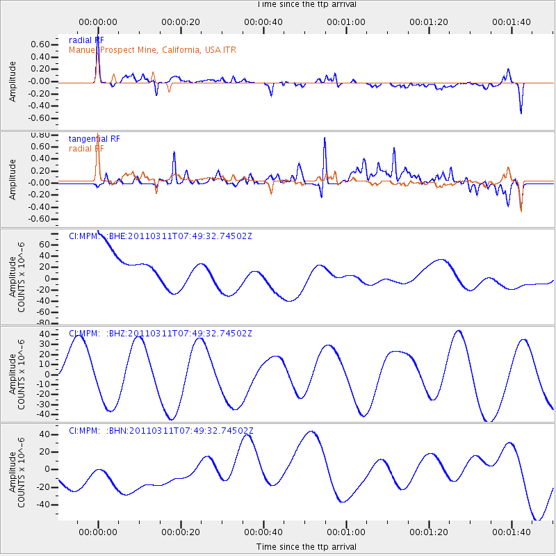
MPM Manuel Prospect Mine, California, USA - Earthquake Result Viewer
*The percent match for this event was below the threshold and hence no stack was calculated.
| Earthquake location: |
Near East Coast Of Honshu, Japan |
| Earthquake latitude/longitude: |
39.2/142.8 |
| Earthquake time(UTC): |
2011/03/11 (070) 07:38:27 GMT |
| Earthquake Depth: |
38 km |
| Earthquake Magnitude: |
5.8 MB |
| Earthquake Catalog/Contributor: |
WHDF/NEIC |
|
| Network: |
CI Caltech Regional Seismic Network |
| Station: |
MPM Manuel Prospect Mine, California, USA |
| Lat/Lon: |
36.06 N/117.49 W |
| Elevation: |
185 m |
|
| Distance: |
74.8 deg |
| Az: |
55.866 deg |
| Baz: |
307.468 deg |
| Ray Param: |
$rayparam |
*The percent match for this event was below the threshold and hence was not used in the summary stack. |
|
| Radial Match: |
62.49195 % |
| Radial Bump: |
400 |
| Transverse Match: |
50.884594 % |
| Transverse Bump: |
400 |
| SOD ConfigId: |
356183 |
| Insert Time: |
2011-08-12 14:58:50.932 +0000 |
| GWidth: |
2.5 |
| Max Bumps: |
400 |
| Tol: |
0.001 |
|
Signal To Noise
| Channel | StoN | STA | LTA |
| CI:MPM: :BHZ:20110311T07:49:32.74502Z | 1.3925163 | 2.6454387E-5 | 1.8997542E-5 |
| CI:MPM: :BHN:20110311T07:49:32.74502Z | 0.97810817 | 3.1436E-5 | 3.2139596E-5 |
| CI:MPM: :BHE:20110311T07:49:32.74502Z | 1.5378734 | 4.3812986E-5 | 2.8489332E-5 |
| Arrivals |
| Ps | |
| PpPs | |
| PsPs/PpSs | |


