You are here: Home > Network List > TA - USArray Transportable Network (new EarthScope stations) Stations List
> Station P30A Selden, KS, USA > Earthquake Result Viewer
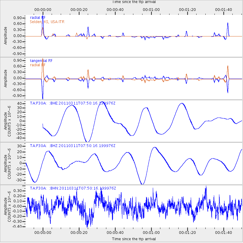
P30A Selden, KS, USA - Earthquake Result Viewer
*The percent match for this event was below the threshold and hence no stack was calculated.
| Earthquake location: |
Near East Coast Of Honshu, Japan |
| Earthquake latitude/longitude: |
39.2/142.8 |
| Earthquake time(UTC): |
2011/03/11 (070) 07:38:27 GMT |
| Earthquake Depth: |
38 km |
| Earthquake Magnitude: |
5.8 MB |
| Earthquake Catalog/Contributor: |
WHDF/NEIC |
|
| Network: |
TA USArray Transportable Network (new EarthScope stations) |
| Station: |
P30A Selden, KS, USA |
| Lat/Lon: |
39.54 N/100.25 W |
| Elevation: |
788 m |
|
| Distance: |
82.7 deg |
| Az: |
44.012 deg |
| Baz: |
315.719 deg |
| Ray Param: |
$rayparam |
*The percent match for this event was below the threshold and hence was not used in the summary stack. |
|
| Radial Match: |
52.97459 % |
| Radial Bump: |
223 |
| Transverse Match: |
52.986954 % |
| Transverse Bump: |
262 |
| SOD ConfigId: |
356183 |
| Insert Time: |
2011-08-12 15:37:40.008 +0000 |
| GWidth: |
2.5 |
| Max Bumps: |
400 |
| Tol: |
0.001 |
|
Signal To Noise
| Channel | StoN | STA | LTA |
| TA:P30A: :BHZ:20110311T07:50:16.199976Z | 1.0037555 | 1.4434217E-5 | 1.43802135E-5 |
| TA:P30A: :BHN:20110311T07:50:16.199976Z | 1.2967094 | 1.4130956E-7 | 1.089755E-7 |
| TA:P30A: :BHE:20110311T07:50:16.199976Z | 1.4888538 | 4.1164505E-5 | 2.7648453E-5 |
| Arrivals |
| Ps | |
| PpPs | |
| PsPs/PpSs | |


