You are here: Home > Network List > TA - USArray Transportable Network (new EarthScope stations) Stations List
> Station D34A Park Rapids, MN, USA > Earthquake Result Viewer
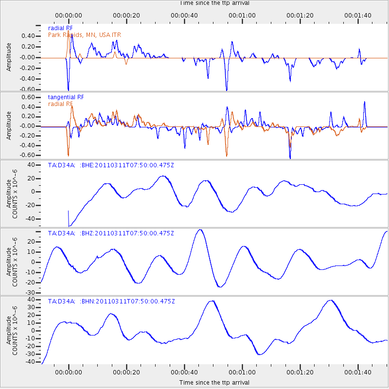
D34A Park Rapids, MN, USA - Earthquake Result Viewer
*The percent match for this event was below the threshold and hence no stack was calculated.
| Earthquake location: |
Near East Coast Of Honshu, Japan |
| Earthquake latitude/longitude: |
39.2/142.8 |
| Earthquake time(UTC): |
2011/03/11 (070) 07:38:27 GMT |
| Earthquake Depth: |
38 km |
| Earthquake Magnitude: |
5.8 MB |
| Earthquake Catalog/Contributor: |
WHDF/NEIC |
|
| Network: |
TA USArray Transportable Network (new EarthScope stations) |
| Station: |
D34A Park Rapids, MN, USA |
| Lat/Lon: |
47.09 N/95.20 W |
| Elevation: |
476 m |
|
| Distance: |
79.7 deg |
| Az: |
36.077 deg |
| Baz: |
317.969 deg |
| Ray Param: |
$rayparam |
*The percent match for this event was below the threshold and hence was not used in the summary stack. |
|
| Radial Match: |
47.812172 % |
| Radial Bump: |
390 |
| Transverse Match: |
66.62733 % |
| Transverse Bump: |
295 |
| SOD ConfigId: |
356183 |
| Insert Time: |
2011-08-12 16:16:12.370 +0000 |
| GWidth: |
2.5 |
| Max Bumps: |
400 |
| Tol: |
0.001 |
|
Signal To Noise
| Channel | StoN | STA | LTA |
| TA:D34A: :BHZ:20110311T07:50:00.475Z | 0.51282734 | 7.935634E-6 | 1.5474281E-5 |
| TA:D34A: :BHN:20110311T07:50:00.475Z | 0.5457405 | 1.2019863E-5 | 2.202487E-5 |
| TA:D34A: :BHE:20110311T07:50:00.475Z | 1.5989926 | 2.8401375E-5 | 1.7762042E-5 |
| Arrivals |
| Ps | |
| PpPs | |
| PsPs/PpSs | |


