You are here: Home > Network List > TA - USArray Transportable Network (new EarthScope stations) Stations List
> Station W33A Caddo, Fort Cobb, OK, USA > Earthquake Result Viewer
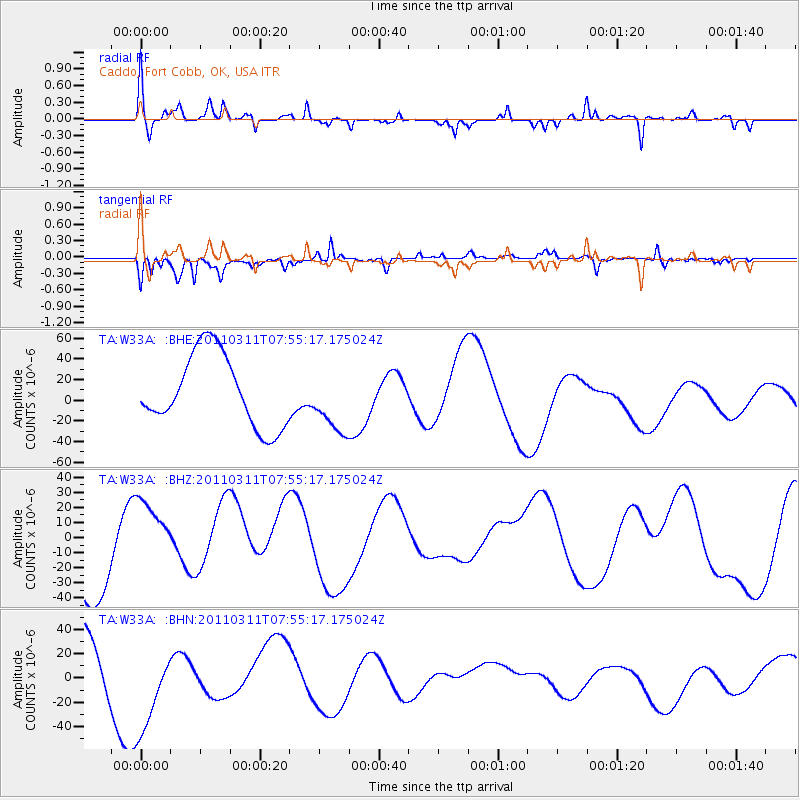
W33A Caddo, Fort Cobb, OK, USA - Earthquake Result Viewer
*The percent match for this event was below the threshold and hence no stack was calculated.
| Earthquake location: |
Near East Coast Of Honshu, Japan |
| Earthquake latitude/longitude: |
36.4/141.9 |
| Earthquake time(UTC): |
2011/03/11 (070) 07:42:55 GMT |
| Earthquake Depth: |
35 km |
| Earthquake Magnitude: |
5.7 MB |
| Earthquake Catalog/Contributor: |
WHDF/NEIC |
|
| Network: |
TA USArray Transportable Network (new EarthScope stations) |
| Station: |
W33A Caddo, Fort Cobb, OK, USA |
| Lat/Lon: |
35.15 N/98.47 W |
| Elevation: |
414 m |
|
| Distance: |
89.3 deg |
| Az: |
45.42 deg |
| Baz: |
315.473 deg |
| Ray Param: |
$rayparam |
*The percent match for this event was below the threshold and hence was not used in the summary stack. |
|
| Radial Match: |
69.59722 % |
| Radial Bump: |
386 |
| Transverse Match: |
61.443275 % |
| Transverse Bump: |
400 |
| SOD ConfigId: |
356183 |
| Insert Time: |
2011-08-12 17:52:48.913 +0000 |
| GWidth: |
2.5 |
| Max Bumps: |
400 |
| Tol: |
0.001 |
|
Signal To Noise
| Channel | StoN | STA | LTA |
| TA:W33A: :BHZ:20110311T07:55:17.175024Z | 0.8917073 | 2.2396378E-5 | 2.511629E-5 |
| TA:W33A: :BHN:20110311T07:55:17.175024Z | 1.8921984 | 4.1339266E-5 | 2.1847214E-5 |
| TA:W33A: :BHE:20110311T07:55:17.175024Z | 0.89656556 | 3.1182455E-5 | 3.4779896E-5 |
| Arrivals |
| Ps | |
| PpPs | |
| PsPs/PpSs | |


