You are here: Home > Network List > TA - USArray Transportable Network (new EarthScope stations) Stations List
> Station V32A Arapaho, OK, USA > Earthquake Result Viewer
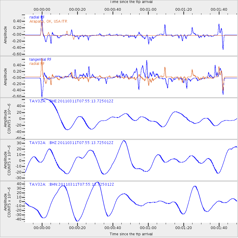
V32A Arapaho, OK, USA - Earthquake Result Viewer
*The percent match for this event was below the threshold and hence no stack was calculated.
| Earthquake location: |
Near East Coast Of Honshu, Japan |
| Earthquake latitude/longitude: |
36.4/141.9 |
| Earthquake time(UTC): |
2011/03/11 (070) 07:42:55 GMT |
| Earthquake Depth: |
35 km |
| Earthquake Magnitude: |
5.7 MB |
| Earthquake Catalog/Contributor: |
WHDF/NEIC |
|
| Network: |
TA USArray Transportable Network (new EarthScope stations) |
| Station: |
V32A Arapaho, OK, USA |
| Lat/Lon: |
35.72 N/99.04 W |
| Elevation: |
533 m |
|
| Distance: |
88.6 deg |
| Az: |
45.355 deg |
| Baz: |
315.14 deg |
| Ray Param: |
$rayparam |
*The percent match for this event was below the threshold and hence was not used in the summary stack. |
|
| Radial Match: |
50.451366 % |
| Radial Bump: |
338 |
| Transverse Match: |
62.454823 % |
| Transverse Bump: |
400 |
| SOD ConfigId: |
356183 |
| Insert Time: |
2011-08-12 17:53:12.271 +0000 |
| GWidth: |
2.5 |
| Max Bumps: |
400 |
| Tol: |
0.001 |
|
Signal To Noise
| Channel | StoN | STA | LTA |
| TA:V32A: :BHZ:20110311T07:55:13.725012Z | 0.67644286 | 1.2572482E-5 | 1.858617E-5 |
| TA:V32A: :BHN:20110311T07:55:13.725012Z | 3.6118433 | 3.657518E-5 | 1.0126459E-5 |
| TA:V32A: :BHE:20110311T07:55:13.725012Z | 0.8427516 | 2.7510985E-5 | 3.264424E-5 |
| Arrivals |
| Ps | |
| PpPs | |
| PsPs/PpSs | |


