You are here: Home > Network List > TA - USArray Transportable Network (new EarthScope stations) Stations List
> Station N34A Lincoln, NE, USA > Earthquake Result Viewer
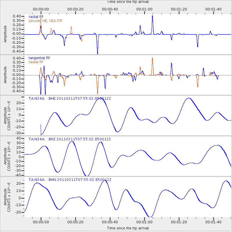
N34A Lincoln, NE, USA - Earthquake Result Viewer
*The percent match for this event was below the threshold and hence no stack was calculated.
| Earthquake location: |
Near East Coast Of Honshu, Japan |
| Earthquake latitude/longitude: |
36.4/141.9 |
| Earthquake time(UTC): |
2011/03/11 (070) 07:42:55 GMT |
| Earthquake Depth: |
35 km |
| Earthquake Magnitude: |
5.7 MB |
| Earthquake Catalog/Contributor: |
WHDF/NEIC |
|
| Network: |
TA USArray Transportable Network (new EarthScope stations) |
| Station: |
N34A Lincoln, NE, USA |
| Lat/Lon: |
40.84 N/96.50 W |
| Elevation: |
401 m |
|
| Distance: |
86.3 deg |
| Az: |
40.354 deg |
| Baz: |
316.489 deg |
| Ray Param: |
$rayparam |
*The percent match for this event was below the threshold and hence was not used in the summary stack. |
|
| Radial Match: |
54.782795 % |
| Radial Bump: |
129 |
| Transverse Match: |
68.43366 % |
| Transverse Bump: |
282 |
| SOD ConfigId: |
356183 |
| Insert Time: |
2011-08-12 17:59:05.726 +0000 |
| GWidth: |
2.5 |
| Max Bumps: |
400 |
| Tol: |
0.001 |
|
Signal To Noise
| Channel | StoN | STA | LTA |
| TA:N34A: :BHZ:20110311T07:55:02.850012Z | 2.561346 | 2.562166E-5 | 1.0003202E-5 |
| TA:N34A: :BHN:20110311T07:55:02.850012Z | 3.5699322 | 2.1792608E-5 | 6.104488E-6 |
| TA:N34A: :BHE:20110311T07:55:02.850012Z | 3.0354567 | 3.0758692E-5 | 1.0133136E-5 |
| Arrivals |
| Ps | |
| PpPs | |
| PsPs/PpSs | |


