You are here: Home > Network List > TA - USArray Transportable Network (new EarthScope stations) Stations List
> Station T30A Plains, KS, USA > Earthquake Result Viewer
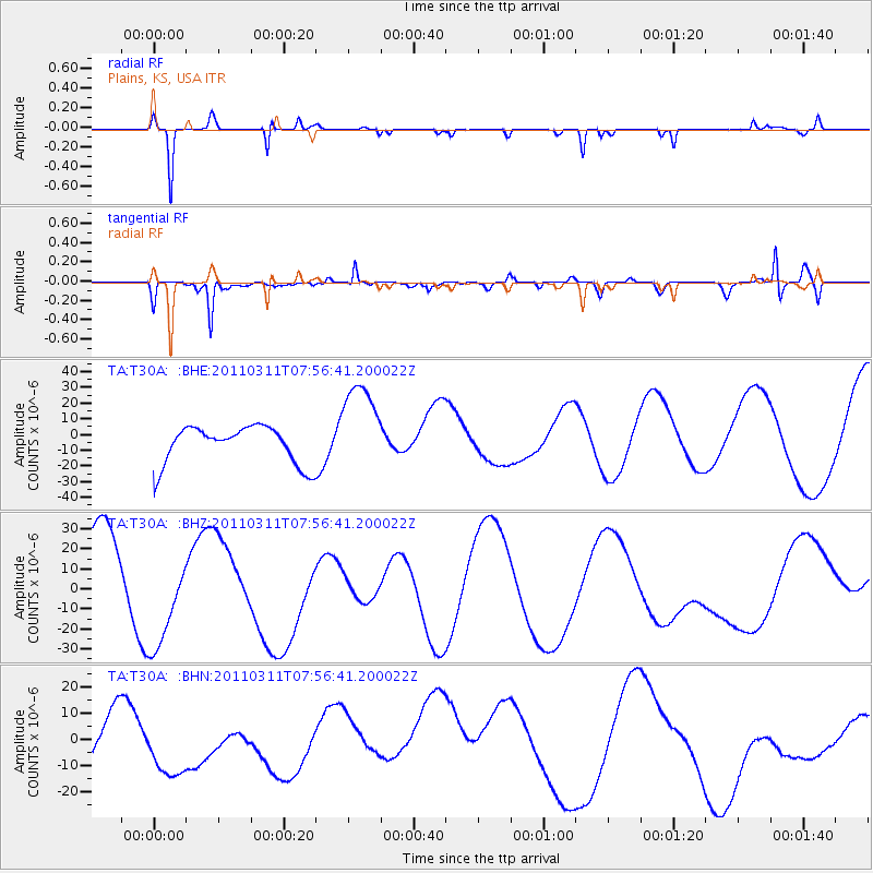
T30A Plains, KS, USA - Earthquake Result Viewer
*The percent match for this event was below the threshold and hence no stack was calculated.
| Earthquake location: |
Near East Coast Of Honshu, Japan |
| Earthquake latitude/longitude: |
36.2/141.8 |
| Earthquake time(UTC): |
2011/03/11 (070) 07:44:27 GMT |
| Earthquake Depth: |
14 km |
| Earthquake Magnitude: |
5.8 MB |
| Earthquake Catalog/Contributor: |
WHDF/NEIC |
|
| Network: |
TA USArray Transportable Network (new EarthScope stations) |
| Station: |
T30A Plains, KS, USA |
| Lat/Lon: |
37.05 N/100.53 W |
| Elevation: |
778 m |
|
| Distance: |
87.0 deg |
| Az: |
45.2 deg |
| Baz: |
314.156 deg |
| Ray Param: |
$rayparam |
*The percent match for this event was below the threshold and hence was not used in the summary stack. |
|
| Radial Match: |
68.70194 % |
| Radial Bump: |
146 |
| Transverse Match: |
61.190357 % |
| Transverse Bump: |
364 |
| SOD ConfigId: |
356183 |
| Insert Time: |
2011-08-12 19:13:18.582 +0000 |
| GWidth: |
2.5 |
| Max Bumps: |
400 |
| Tol: |
0.001 |
|
Signal To Noise
| Channel | StoN | STA | LTA |
| TA:T30A: :BHZ:20110311T07:56:41.200022Z | 1.2204595 | 2.2954962E-5 | 1.880846E-5 |
| TA:T30A: :BHN:20110311T07:56:41.200022Z | 1.6682149 | 1.43457855E-5 | 8.5994825E-6 |
| TA:T30A: :BHE:20110311T07:56:41.200022Z | 2.4954271 | 2.990091E-5 | 1.1982281E-5 |
| Arrivals |
| Ps | |
| PpPs | |
| PsPs/PpSs | |


