You are here: Home > Network List > TA - USArray Transportable Network (new EarthScope stations) Stations List
> Station R31A Burdett, KS, USA > Earthquake Result Viewer
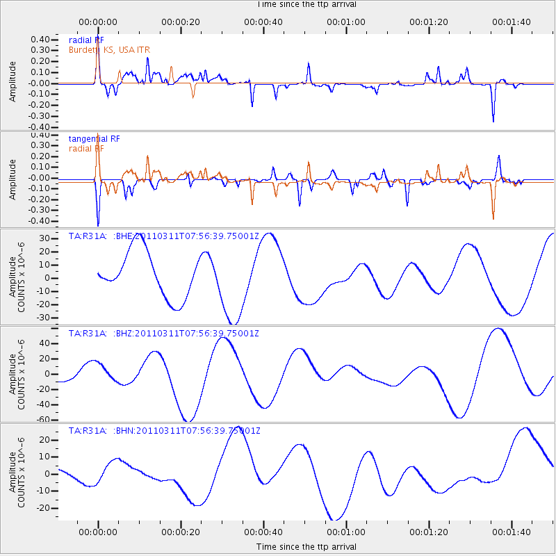
R31A Burdett, KS, USA - Earthquake Result Viewer
*The percent match for this event was below the threshold and hence no stack was calculated.
| Earthquake location: |
Near East Coast Of Honshu, Japan |
| Earthquake latitude/longitude: |
36.2/141.8 |
| Earthquake time(UTC): |
2011/03/11 (070) 07:44:27 GMT |
| Earthquake Depth: |
14 km |
| Earthquake Magnitude: |
5.8 MB |
| Earthquake Catalog/Contributor: |
WHDF/NEIC |
|
| Network: |
TA USArray Transportable Network (new EarthScope stations) |
| Station: |
R31A Burdett, KS, USA |
| Lat/Lon: |
38.29 N/99.53 W |
| Elevation: |
667 m |
|
| Distance: |
86.7 deg |
| Az: |
43.761 deg |
| Baz: |
314.686 deg |
| Ray Param: |
$rayparam |
*The percent match for this event was below the threshold and hence was not used in the summary stack. |
|
| Radial Match: |
65.44896 % |
| Radial Bump: |
400 |
| Transverse Match: |
56.380604 % |
| Transverse Bump: |
246 |
| SOD ConfigId: |
356183 |
| Insert Time: |
2011-08-12 19:14:25.284 +0000 |
| GWidth: |
2.5 |
| Max Bumps: |
400 |
| Tol: |
0.001 |
|
Signal To Noise
| Channel | StoN | STA | LTA |
| TA:R31A: :BHZ:20110311T07:56:39.75001Z | 0.92017716 | 1.2675615E-5 | 1.37751895E-5 |
| TA:R31A: :BHN:20110311T07:56:39.75001Z | 1.7104218 | 7.747112E-6 | 4.5293577E-6 |
| TA:R31A: :BHE:20110311T07:56:39.75001Z | 1.7741429 | 3.0666542E-5 | 1.728527E-5 |
| Arrivals |
| Ps | |
| PpPs | |
| PsPs/PpSs | |


