You are here: Home > Network List > TA - USArray Transportable Network (new EarthScope stations) Stations List
> Station I28A Midland, SD, USA > Earthquake Result Viewer
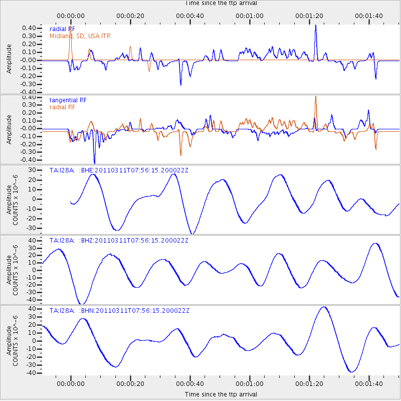
I28A Midland, SD, USA - Earthquake Result Viewer
*The percent match for this event was below the threshold and hence no stack was calculated.
| Earthquake location: |
Near East Coast Of Honshu, Japan |
| Earthquake latitude/longitude: |
36.2/141.8 |
| Earthquake time(UTC): |
2011/03/11 (070) 07:44:27 GMT |
| Earthquake Depth: |
14 km |
| Earthquake Magnitude: |
5.8 MB |
| Earthquake Catalog/Contributor: |
WHDF/NEIC |
|
| Network: |
TA USArray Transportable Network (new EarthScope stations) |
| Station: |
I28A Midland, SD, USA |
| Lat/Lon: |
44.00 N/101.17 W |
| Elevation: |
655 m |
|
| Distance: |
81.8 deg |
| Az: |
40.502 deg |
| Baz: |
313.283 deg |
| Ray Param: |
$rayparam |
*The percent match for this event was below the threshold and hence was not used in the summary stack. |
|
| Radial Match: |
54.949738 % |
| Radial Bump: |
400 |
| Transverse Match: |
45.151356 % |
| Transverse Bump: |
287 |
| SOD ConfigId: |
356183 |
| Insert Time: |
2011-08-12 19:16:30.421 +0000 |
| GWidth: |
2.5 |
| Max Bumps: |
400 |
| Tol: |
0.001 |
|
Signal To Noise
| Channel | StoN | STA | LTA |
| TA:I28A: :BHZ:20110311T07:56:15.200022Z | 2.4740424 | 3.5949906E-5 | 1.4530837E-5 |
| TA:I28A: :BHN:20110311T07:56:15.200022Z | 1.4004805 | 2.0845859E-5 | 1.488479E-5 |
| TA:I28A: :BHE:20110311T07:56:15.200022Z | 1.1213505 | 1.9425002E-5 | 1.7322864E-5 |
| Arrivals |
| Ps | |
| PpPs | |
| PsPs/PpSs | |


