You are here: Home > Network List > UU - University of Utah Regional Network Stations List
> Station CCUT Cedar City, UT, USA > Earthquake Result Viewer
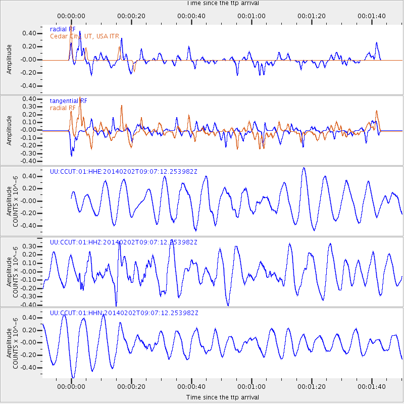
CCUT Cedar City, UT, USA - Earthquake Result Viewer
*The percent match for this event was below the threshold and hence no stack was calculated.
| Earthquake location: |
Near Coast Of Peru |
| Earthquake latitude/longitude: |
-15.9/-74.1 |
| Earthquake time(UTC): |
2014/02/02 (033) 08:57:09 GMT |
| Earthquake Depth: |
45 km |
| Earthquake Magnitude: |
5.2 MW |
| Earthquake Catalog/Contributor: |
ISC/ISC |
|
| Network: |
UU University of Utah Regional Network |
| Station: |
CCUT Cedar City, UT, USA |
| Lat/Lon: |
37.55 N/113.36 W |
| Elevation: |
2127 m |
|
| Distance: |
64.7 deg |
| Az: |
326.233 deg |
| Baz: |
137.715 deg |
| Ray Param: |
$rayparam |
*The percent match for this event was below the threshold and hence was not used in the summary stack. |
|
| Radial Match: |
46.194798 % |
| Radial Bump: |
400 |
| Transverse Match: |
40.65795 % |
| Transverse Bump: |
278 |
| SOD ConfigId: |
3390531 |
| Insert Time: |
2019-04-10 04:46:16.807 +0000 |
| GWidth: |
2.5 |
| Max Bumps: |
400 |
| Tol: |
0.001 |
|
Signal To Noise
| Channel | StoN | STA | LTA |
| UU:CCUT:01:HHZ:20140202T09:07:12.253982Z | 0.60709685 | 1.2461076E-7 | 2.0525682E-7 |
| UU:CCUT:01:HHN:20140202T09:07:12.253982Z | 1.7549987 | 3.5785746E-7 | 2.0390755E-7 |
| UU:CCUT:01:HHE:20140202T09:07:12.253982Z | 1.435957 | 2.6460134E-7 | 1.8426829E-7 |
| Arrivals |
| Ps | |
| PpPs | |
| PsPs/PpSs | |


