You are here: Home > Network List > TA - USArray Transportable Network (new EarthScope stations) Stations List
> Station Y35A Marietta, OK, USA > Earthquake Result Viewer
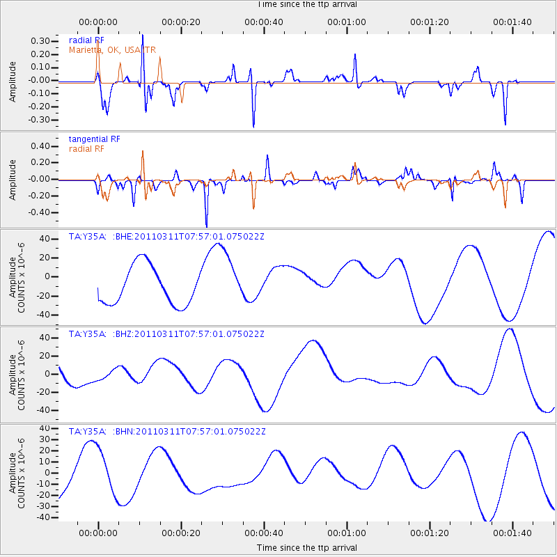
Y35A Marietta, OK, USA - Earthquake Result Viewer
*The percent match for this event was below the threshold and hence no stack was calculated.
| Earthquake location: |
Near East Coast Of Honshu, Japan |
| Earthquake latitude/longitude: |
36.2/141.8 |
| Earthquake time(UTC): |
2011/03/11 (070) 07:44:27 GMT |
| Earthquake Depth: |
14 km |
| Earthquake Magnitude: |
5.8 MB |
| Earthquake Catalog/Contributor: |
WHDF/NEIC |
|
| Network: |
TA USArray Transportable Network (new EarthScope stations) |
| Station: |
Y35A Marietta, OK, USA |
| Lat/Lon: |
33.91 N/97.04 W |
| Elevation: |
214 m |
|
| Distance: |
91.2 deg |
| Az: |
45.393 deg |
| Baz: |
316.177 deg |
| Ray Param: |
$rayparam |
*The percent match for this event was below the threshold and hence was not used in the summary stack. |
|
| Radial Match: |
53.686707 % |
| Radial Bump: |
199 |
| Transverse Match: |
80.409195 % |
| Transverse Bump: |
251 |
| SOD ConfigId: |
356183 |
| Insert Time: |
2011-08-12 19:34:26.595 +0000 |
| GWidth: |
2.5 |
| Max Bumps: |
400 |
| Tol: |
0.001 |
|
Signal To Noise
| Channel | StoN | STA | LTA |
| TA:Y35A: :BHZ:20110311T07:57:01.075022Z | 0.30774635 | 6.374733E-6 | 2.0714246E-5 |
| TA:Y35A: :BHN:20110311T07:57:01.075022Z | 1.105421 | 1.9475812E-5 | 1.7618459E-5 |
| TA:Y35A: :BHE:20110311T07:57:01.075022Z | 1.512746 | 2.9714864E-5 | 1.9642996E-5 |
| Arrivals |
| Ps | |
| PpPs | |
| PsPs/PpSs | |


