You are here: Home > Network List > TA - USArray Transportable Network (new EarthScope stations) Stations List
> Station D33A AnnSam, Waubun, MN, USA > Earthquake Result Viewer
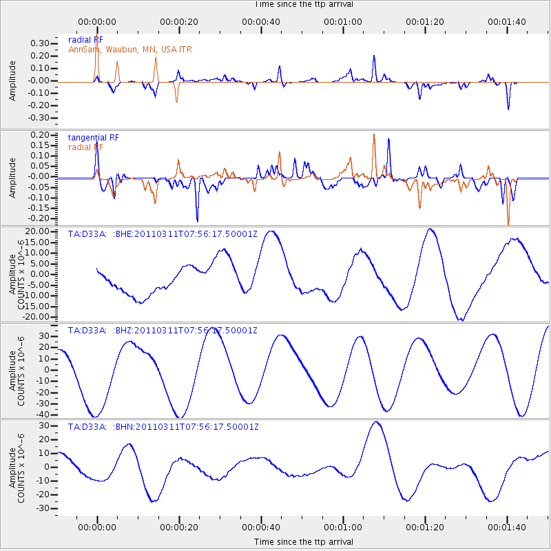
D33A AnnSam, Waubun, MN, USA - Earthquake Result Viewer
*The percent match for this event was below the threshold and hence no stack was calculated.
| Earthquake location: |
Near East Coast Of Honshu, Japan |
| Earthquake latitude/longitude: |
36.2/141.8 |
| Earthquake time(UTC): |
2011/03/11 (070) 07:44:27 GMT |
| Earthquake Depth: |
14 km |
| Earthquake Magnitude: |
5.8 MB |
| Earthquake Catalog/Contributor: |
WHDF/NEIC |
|
| Network: |
TA USArray Transportable Network (new EarthScope stations) |
| Station: |
D33A AnnSam, Waubun, MN, USA |
| Lat/Lon: |
47.14 N/95.84 W |
| Elevation: |
466 m |
|
| Distance: |
82.3 deg |
| Az: |
35.593 deg |
| Baz: |
316.397 deg |
| Ray Param: |
$rayparam |
*The percent match for this event was below the threshold and hence was not used in the summary stack. |
|
| Radial Match: |
61.811695 % |
| Radial Bump: |
256 |
| Transverse Match: |
54.479397 % |
| Transverse Bump: |
356 |
| SOD ConfigId: |
356183 |
| Insert Time: |
2011-08-12 19:42:33.268 +0000 |
| GWidth: |
2.5 |
| Max Bumps: |
400 |
| Tol: |
0.001 |
|
Signal To Noise
| Channel | StoN | STA | LTA |
| TA:D33A: :BHZ:20110311T07:56:17.50001Z | 2.1061366 | 3.1884407E-5 | 1.5138812E-5 |
| TA:D33A: :BHN:20110311T07:56:17.50001Z | 0.9504395 | 9.080475E-6 | 9.553974E-6 |
| TA:D33A: :BHE:20110311T07:56:17.50001Z | 2.3099813 | 1.2529674E-5 | 5.424145E-6 |
| Arrivals |
| Ps | |
| PpPs | |
| PsPs/PpSs | |


