You are here: Home > Network List > TA - USArray Transportable Network (new EarthScope stations) Stations List
> Station N29A Votaw Ranch, Wellfleet, NE, USA > Earthquake Result Viewer
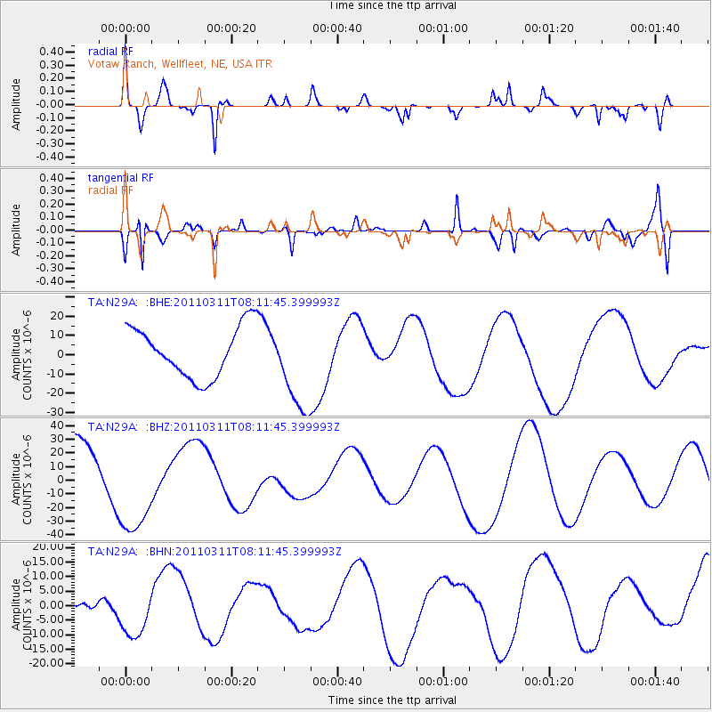
N29A Votaw Ranch, Wellfleet, NE, USA - Earthquake Result Viewer
*The percent match for this event was below the threshold and hence no stack was calculated.
| Earthquake location: |
Off East Coast Of Honshu, Japan |
| Earthquake latitude/longitude: |
37.0/142.8 |
| Earthquake time(UTC): |
2011/03/11 (070) 07:59:48 GMT |
| Earthquake Depth: |
0.7 km |
| Earthquake Magnitude: |
5.7 MB |
| Earthquake Catalog/Contributor: |
WHDF/NEIC |
|
| Network: |
TA USArray Transportable Network (new EarthScope stations) |
| Station: |
N29A Votaw Ranch, Wellfleet, NE, USA |
| Lat/Lon: |
40.82 N/100.63 W |
| Elevation: |
897 m |
|
| Distance: |
83.2 deg |
| Az: |
43.114 deg |
| Baz: |
313.877 deg |
| Ray Param: |
$rayparam |
*The percent match for this event was below the threshold and hence was not used in the summary stack. |
|
| Radial Match: |
67.73384 % |
| Radial Bump: |
400 |
| Transverse Match: |
58.04646 % |
| Transverse Bump: |
371 |
| SOD ConfigId: |
356183 |
| Insert Time: |
2011-08-12 23:39:18.716 +0000 |
| GWidth: |
2.5 |
| Max Bumps: |
400 |
| Tol: |
0.001 |
|
Signal To Noise
| Channel | StoN | STA | LTA |
| TA:N29A: :BHZ:20110311T08:11:45.399993Z | 1.238574 | 3.1097083E-5 | 2.5107165E-5 |
| TA:N29A: :BHN:20110311T08:11:45.399993Z | 2.6524107 | 8.8384095E-6 | 3.3322176E-6 |
| TA:N29A: :BHE:20110311T08:11:45.399993Z | 1.8540671 | 2.4238498E-5 | 1.307315E-5 |
| Arrivals |
| Ps | |
| PpPs | |
| PsPs/PpSs | |


