You are here: Home > Network List > TA - USArray Transportable Network (new EarthScope stations) Stations List
> Station P59A Jarrettsville, MD, USA > Earthquake Result Viewer
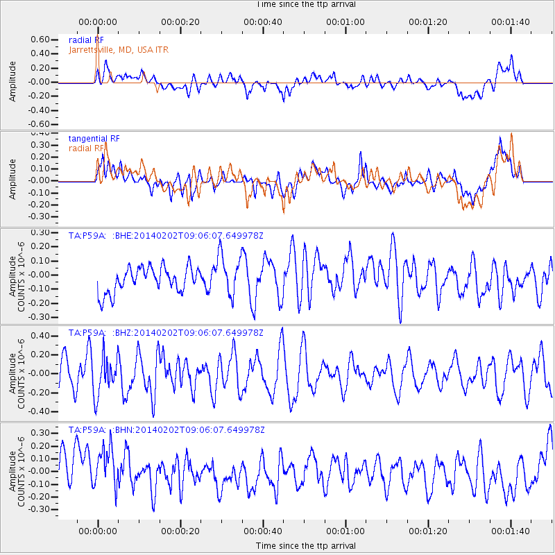
P59A Jarrettsville, MD, USA - Earthquake Result Viewer
*The percent match for this event was below the threshold and hence no stack was calculated.
| Earthquake location: |
Near Coast Of Peru |
| Earthquake latitude/longitude: |
-15.9/-74.1 |
| Earthquake time(UTC): |
2014/02/02 (033) 08:57:09 GMT |
| Earthquake Depth: |
45 km |
| Earthquake Magnitude: |
5.2 MW |
| Earthquake Catalog/Contributor: |
ISC/ISC |
|
| Network: |
TA USArray Transportable Network (new EarthScope stations) |
| Station: |
P59A Jarrettsville, MD, USA |
| Lat/Lon: |
39.61 N/76.43 W |
| Elevation: |
157 m |
|
| Distance: |
55.3 deg |
| Az: |
357.839 deg |
| Baz: |
177.309 deg |
| Ray Param: |
$rayparam |
*The percent match for this event was below the threshold and hence was not used in the summary stack. |
|
| Radial Match: |
28.276562 % |
| Radial Bump: |
400 |
| Transverse Match: |
33.005062 % |
| Transverse Bump: |
400 |
| SOD ConfigId: |
3390531 |
| Insert Time: |
2019-04-10 04:45:21.929 +0000 |
| GWidth: |
2.5 |
| Max Bumps: |
400 |
| Tol: |
0.001 |
|
Signal To Noise
| Channel | StoN | STA | LTA |
| TA:P59A: :BHZ:20140202T09:06:07.649978Z | 1.5228064 | 2.0426877E-7 | 1.341397E-7 |
| TA:P59A: :BHN:20140202T09:06:07.649978Z | 1.1343056 | 1.5249432E-7 | 1.3443848E-7 |
| TA:P59A: :BHE:20140202T09:06:07.649978Z | 1.6832078 | 1.500325E-7 | 8.913487E-8 |
| Arrivals |
| Ps | |
| PpPs | |
| PsPs/PpSs | |


