You are here: Home > Network List > TA - USArray Transportable Network (new EarthScope stations) Stations List
> Station WHTX Lake Whitney, Meridian, TX, USA > Earthquake Result Viewer
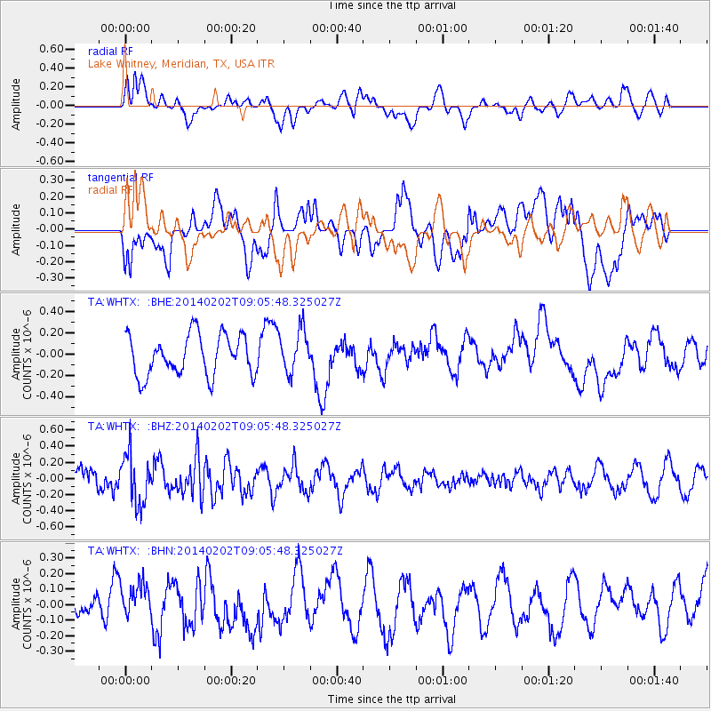
WHTX Lake Whitney, Meridian, TX, USA - Earthquake Result Viewer
*The percent match for this event was below the threshold and hence no stack was calculated.
| Earthquake location: |
Near Coast Of Peru |
| Earthquake latitude/longitude: |
-15.9/-74.1 |
| Earthquake time(UTC): |
2014/02/02 (033) 08:57:09 GMT |
| Earthquake Depth: |
45 km |
| Earthquake Magnitude: |
5.2 MW |
| Earthquake Catalog/Contributor: |
ISC/ISC |
|
| Network: |
TA USArray Transportable Network (new EarthScope stations) |
| Station: |
WHTX Lake Whitney, Meridian, TX, USA |
| Lat/Lon: |
31.99 N/97.46 W |
| Elevation: |
190 m |
|
| Distance: |
52.6 deg |
| Az: |
334.958 deg |
| Baz: |
151.363 deg |
| Ray Param: |
$rayparam |
*The percent match for this event was below the threshold and hence was not used in the summary stack. |
|
| Radial Match: |
59.884552 % |
| Radial Bump: |
400 |
| Transverse Match: |
54.58964 % |
| Transverse Bump: |
400 |
| SOD ConfigId: |
3390531 |
| Insert Time: |
2019-04-10 04:45:44.354 +0000 |
| GWidth: |
2.5 |
| Max Bumps: |
400 |
| Tol: |
0.001 |
|
Signal To Noise
| Channel | StoN | STA | LTA |
| TA:WHTX: :BHZ:20140202T09:05:48.325027Z | 1.9315772 | 3.087602E-7 | 1.5984874E-7 |
| TA:WHTX: :BHN:20140202T09:05:48.325027Z | 1.0124568 | 1.1396192E-7 | 1.1255978E-7 |
| TA:WHTX: :BHE:20140202T09:05:48.325027Z | 1.040201 | 1.9782874E-7 | 1.901832E-7 |
| Arrivals |
| Ps | |
| PpPs | |
| PsPs/PpSs | |


