You are here: Home > Network List > US - United States National Seismic Network Stations List
> Station AMTX Amarillo, Texas, USA > Earthquake Result Viewer
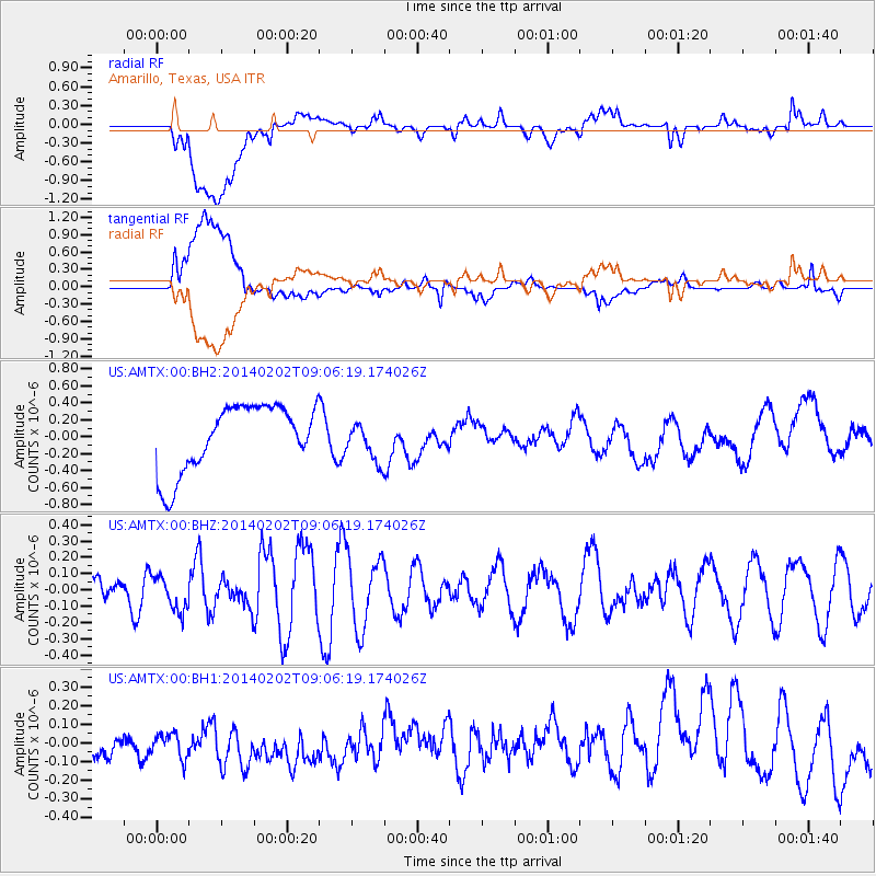
AMTX Amarillo, Texas, USA - Earthquake Result Viewer
*The percent match for this event was below the threshold and hence no stack was calculated.
| Earthquake location: |
Near Coast Of Peru |
| Earthquake latitude/longitude: |
-15.9/-74.1 |
| Earthquake time(UTC): |
2014/02/02 (033) 08:57:09 GMT |
| Earthquake Depth: |
45 km |
| Earthquake Magnitude: |
5.2 MW |
| Earthquake Catalog/Contributor: |
ISC/ISC |
|
| Network: |
US United States National Seismic Network |
| Station: |
AMTX Amarillo, Texas, USA |
| Lat/Lon: |
34.53 N/101.41 W |
| Elevation: |
1010 m |
|
| Distance: |
56.5 deg |
| Az: |
333.014 deg |
| Baz: |
148.076 deg |
| Ray Param: |
$rayparam |
*The percent match for this event was below the threshold and hence was not used in the summary stack. |
|
| Radial Match: |
46.95691 % |
| Radial Bump: |
400 |
| Transverse Match: |
35.862114 % |
| Transverse Bump: |
400 |
| SOD ConfigId: |
3390531 |
| Insert Time: |
2019-04-10 04:46:06.354 +0000 |
| GWidth: |
2.5 |
| Max Bumps: |
400 |
| Tol: |
0.001 |
|
Signal To Noise
| Channel | StoN | STA | LTA |
| US:AMTX:00:BHZ:20140202T09:06:19.174026Z | 0.7156515 | 1.0410496E-7 | 1.454688E-7 |
| US:AMTX:00:BH1:20140202T09:06:19.174026Z | 0.7171342 | 1.5842267E-7 | 2.2091076E-7 |
| US:AMTX:00:BH2:20140202T09:06:19.174026Z | 0.4728483 | 1.935718E-7 | 4.0937397E-7 |
| Arrivals |
| Ps | |
| PpPs | |
| PsPs/PpSs | |


