You are here: Home > Network List > US - United States National Seismic Network Stations List
> Station WMOK Wichita Mountains, Oklahoma, USA > Earthquake Result Viewer
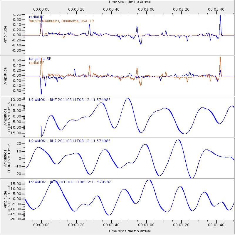
WMOK Wichita Mountains, Oklahoma, USA - Earthquake Result Viewer
*The percent match for this event was below the threshold and hence no stack was calculated.
| Earthquake location: |
Off East Coast Of Honshu, Japan |
| Earthquake latitude/longitude: |
37.0/142.8 |
| Earthquake time(UTC): |
2011/03/11 (070) 07:59:48 GMT |
| Earthquake Depth: |
0.7 km |
| Earthquake Magnitude: |
5.7 MB |
| Earthquake Catalog/Contributor: |
WHDF/NEIC |
|
| Network: |
US United States National Seismic Network |
| Station: |
WMOK Wichita Mountains, Oklahoma, USA |
| Lat/Lon: |
34.74 N/98.78 W |
| Elevation: |
486 m |
|
| Distance: |
88.5 deg |
| Az: |
46.42 deg |
| Baz: |
315.244 deg |
| Ray Param: |
$rayparam |
*The percent match for this event was below the threshold and hence was not used in the summary stack. |
|
| Radial Match: |
49.638058 % |
| Radial Bump: |
400 |
| Transverse Match: |
66.402336 % |
| Transverse Bump: |
357 |
| SOD ConfigId: |
356183 |
| Insert Time: |
2011-08-13 00:13:02.010 +0000 |
| GWidth: |
2.5 |
| Max Bumps: |
400 |
| Tol: |
0.001 |
|
Signal To Noise
| Channel | StoN | STA | LTA |
| US:WMOK: :BHZ:20110311T08:12:11.57498Z | 3.205713 | 1.43290645E-5 | 4.4698527E-6 |
| US:WMOK: :BHN:20110311T08:12:11.57498Z | 0.95409715 | 7.514562E-6 | 7.876098E-6 |
| US:WMOK: :BHE:20110311T08:12:11.57498Z | 3.0741925 | 1.4649871E-5 | 4.765437E-6 |
| Arrivals |
| Ps | |
| PpPs | |
| PsPs/PpSs | |


