You are here: Home > Network List > TA - USArray Transportable Network (new EarthScope stations) Stations List
> Station P30A Selden, KS, USA > Earthquake Result Viewer
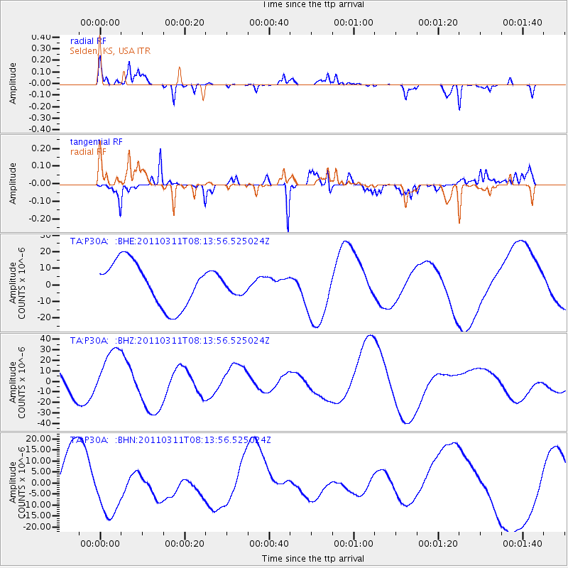
P30A Selden, KS, USA - Earthquake Result Viewer
*The percent match for this event was below the threshold and hence no stack was calculated.
| Earthquake location: |
Off East Coast Of Honshu, Japan |
| Earthquake latitude/longitude: |
36.9/142.7 |
| Earthquake time(UTC): |
2011/03/11 (070) 08:01:57 GMT |
| Earthquake Depth: |
19 km |
| Earthquake Magnitude: |
5.9 MB |
| Earthquake Catalog/Contributor: |
WHDF/NEIC |
|
| Network: |
TA USArray Transportable Network (new EarthScope stations) |
| Station: |
P30A Selden, KS, USA |
| Lat/Lon: |
39.54 N/100.25 W |
| Elevation: |
788 m |
|
| Distance: |
84.4 deg |
| Az: |
43.783 deg |
| Baz: |
314.193 deg |
| Ray Param: |
$rayparam |
*The percent match for this event was below the threshold and hence was not used in the summary stack. |
|
| Radial Match: |
48.89518 % |
| Radial Bump: |
218 |
| Transverse Match: |
67.448235 % |
| Transverse Bump: |
231 |
| SOD ConfigId: |
356183 |
| Insert Time: |
2011-08-13 01:20:57.792 +0000 |
| GWidth: |
2.5 |
| Max Bumps: |
400 |
| Tol: |
0.001 |
|
Signal To Noise
| Channel | StoN | STA | LTA |
| TA:P30A: :BHZ:20110311T08:13:56.525024Z | 1.0063444 | 2.2078611E-5 | 2.1939417E-5 |
| TA:P30A: :BHN:20110311T08:13:56.525024Z | 1.3790252 | 1.3026442E-5 | 9.446123E-6 |
| TA:P30A: :BHE:20110311T08:13:56.525024Z | 0.3648821 | 4.8886077E-6 | 1.3397774E-5 |
| Arrivals |
| Ps | |
| PpPs | |
| PsPs/PpSs | |


