You are here: Home > Network List > UW - Pacific Northwest Regional Seismic Network Stations List
> Station HEBO Mt. Hebo, OR CREST BB SMO > Earthquake Result Viewer
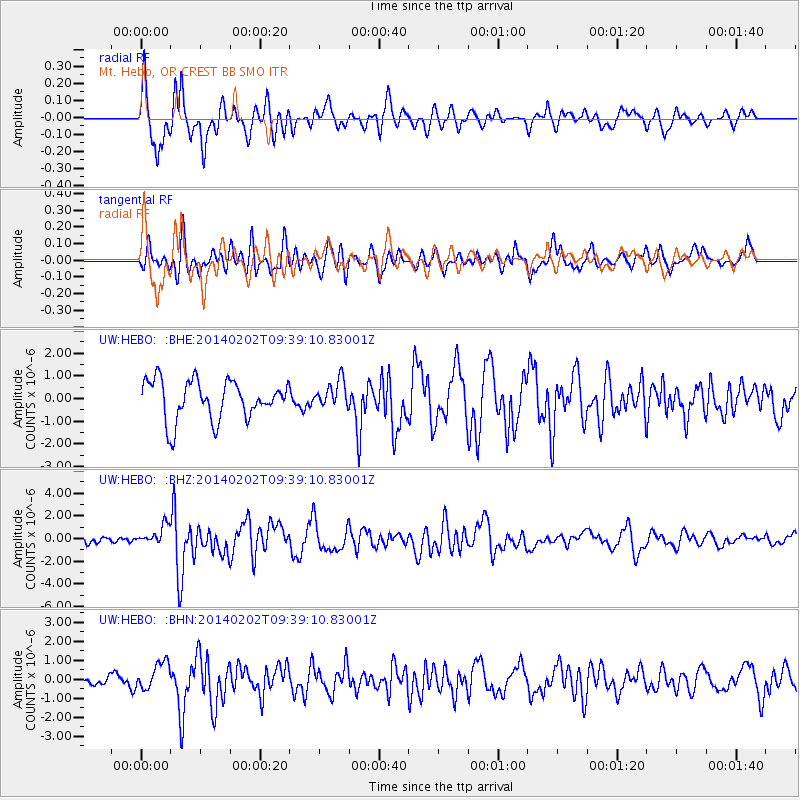
HEBO Mt. Hebo, OR CREST BB SMO - Earthquake Result Viewer
*The percent match for this event was below the threshold and hence no stack was calculated.
| Earthquake location: |
South Of Kermadec Islands |
| Earthquake latitude/longitude: |
-32.9/-177.9 |
| Earthquake time(UTC): |
2014/02/02 (033) 09:26:37 GMT |
| Earthquake Depth: |
44 km |
| Earthquake Magnitude: |
6.5 MWW, 6.5 MWC, 6.5 MI |
| Earthquake Catalog/Contributor: |
NEIC PDE/NEIC COMCAT |
|
| Network: |
UW Pacific Northwest Regional Seismic Network |
| Station: |
HEBO Mt. Hebo, OR CREST BB SMO |
| Lat/Lon: |
45.21 N/123.76 W |
| Elevation: |
875 m |
|
| Distance: |
92.0 deg |
| Az: |
34.966 deg |
| Baz: |
223.002 deg |
| Ray Param: |
$rayparam |
*The percent match for this event was below the threshold and hence was not used in the summary stack. |
|
| Radial Match: |
75.51494 % |
| Radial Bump: |
400 |
| Transverse Match: |
67.47024 % |
| Transverse Bump: |
400 |
| SOD ConfigId: |
3390531 |
| Insert Time: |
2019-04-10 04:50:57.485 +0000 |
| GWidth: |
2.5 |
| Max Bumps: |
400 |
| Tol: |
0.001 |
|
Signal To Noise
| Channel | StoN | STA | LTA |
| UW:HEBO: :BHZ:20140202T09:39:10.83001Z | 1.5844332 | 8.697194E-7 | 5.489151E-7 |
| UW:HEBO: :BHN:20140202T09:39:10.83001Z | 1.3589247 | 7.233237E-7 | 5.322765E-7 |
| UW:HEBO: :BHE:20140202T09:39:10.83001Z | 0.6980717 | 6.0165047E-7 | 8.618748E-7 |
| Arrivals |
| Ps | |
| PpPs | |
| PsPs/PpSs | |


