You are here: Home > Network List > TA - USArray Transportable Network (new EarthScope stations) Stations List
> Station O56A Blue Knob State Park, Imler, PA, USA > Earthquake Result Viewer
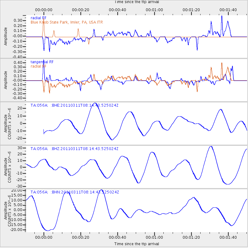
O56A Blue Knob State Park, Imler, PA, USA - Earthquake Result Viewer
*The percent match for this event was below the threshold and hence no stack was calculated.
| Earthquake location: |
Off East Coast Of Honshu, Japan |
| Earthquake latitude/longitude: |
36.9/142.7 |
| Earthquake time(UTC): |
2011/03/11 (070) 08:01:57 GMT |
| Earthquake Depth: |
19 km |
| Earthquake Magnitude: |
5.9 MB |
| Earthquake Catalog/Contributor: |
WHDF/NEIC |
|
| Network: |
TA USArray Transportable Network (new EarthScope stations) |
| Station: |
O56A Blue Knob State Park, Imler, PA, USA |
| Lat/Lon: |
40.27 N/78.57 W |
| Elevation: |
684 m |
|
| Distance: |
94.3 deg |
| Az: |
30.406 deg |
| Baz: |
327.996 deg |
| Ray Param: |
$rayparam |
*The percent match for this event was below the threshold and hence was not used in the summary stack. |
|
| Radial Match: |
58.64184 % |
| Radial Bump: |
400 |
| Transverse Match: |
50.792168 % |
| Transverse Bump: |
335 |
| SOD ConfigId: |
356183 |
| Insert Time: |
2011-08-13 01:54:58.846 +0000 |
| GWidth: |
2.5 |
| Max Bumps: |
400 |
| Tol: |
0.001 |
|
Signal To Noise
| Channel | StoN | STA | LTA |
| TA:O56A: :BHZ:20110311T08:14:43.525024Z | 0.9670124 | 9.153811E-6 | 9.4660745E-6 |
| TA:O56A: :BHN:20110311T08:14:43.525024Z | 3.0520172 | 2.1995276E-5 | 7.2068E-6 |
| TA:O56A: :BHE:20110311T08:14:43.525024Z | 2.2284367 | 1.5492362E-5 | 6.9521207E-6 |
| Arrivals |
| Ps | |
| PpPs | |
| PsPs/PpSs | |


