You are here: Home > Network List > TA - USArray Transportable Network (new EarthScope stations) Stations List
> Station H25A Fruitdale, SD, USA > Earthquake Result Viewer
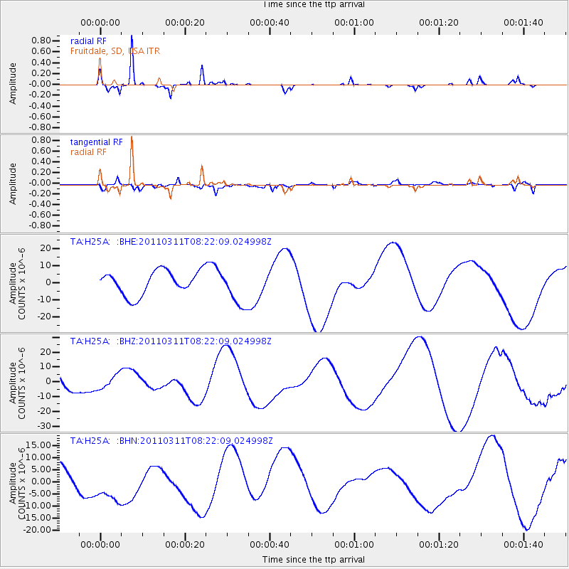
H25A Fruitdale, SD, USA - Earthquake Result Viewer
*The percent match for this event was below the threshold and hence no stack was calculated.
| Earthquake location: |
Near East Coast Of Honshu, Japan |
| Earthquake latitude/longitude: |
36.3/140.9 |
| Earthquake time(UTC): |
2011/03/11 (070) 08:10:29 GMT |
| Earthquake Depth: |
20 km |
| Earthquake Magnitude: |
5.6 MB |
| Earthquake Catalog/Contributor: |
WHDF/NEIC |
|
| Network: |
TA USArray Transportable Network (new EarthScope stations) |
| Station: |
H25A Fruitdale, SD, USA |
| Lat/Lon: |
44.62 N/103.60 W |
| Elevation: |
942 m |
|
| Distance: |
80.6 deg |
| Az: |
40.775 deg |
| Baz: |
312.362 deg |
| Ray Param: |
$rayparam |
*The percent match for this event was below the threshold and hence was not used in the summary stack. |
|
| Radial Match: |
90.24359 % |
| Radial Bump: |
240 |
| Transverse Match: |
25.465834 % |
| Transverse Bump: |
324 |
| SOD ConfigId: |
356183 |
| Insert Time: |
2011-08-13 04:24:28.394 +0000 |
| GWidth: |
2.5 |
| Max Bumps: |
400 |
| Tol: |
0.001 |
|
Signal To Noise
| Channel | StoN | STA | LTA |
| TA:H25A: :BHZ:20110311T08:22:09.024998Z | 0.5544564 | 5.078778E-6 | 9.159923E-6 |
| TA:H25A: :BHN:20110311T08:22:09.024998Z | 1.5694873 | 8.860386E-6 | 5.645401E-6 |
| TA:H25A: :BHE:20110311T08:22:09.024998Z | 1.6372349 | 1.1247922E-5 | 6.870072E-6 |
| Arrivals |
| Ps | |
| PpPs | |
| PsPs/PpSs | |


