You are here: Home > Network List > TA - USArray Transportable Network (new EarthScope stations) Stations List
> Station J01D Myrtle Point, OR, USA > Earthquake Result Viewer
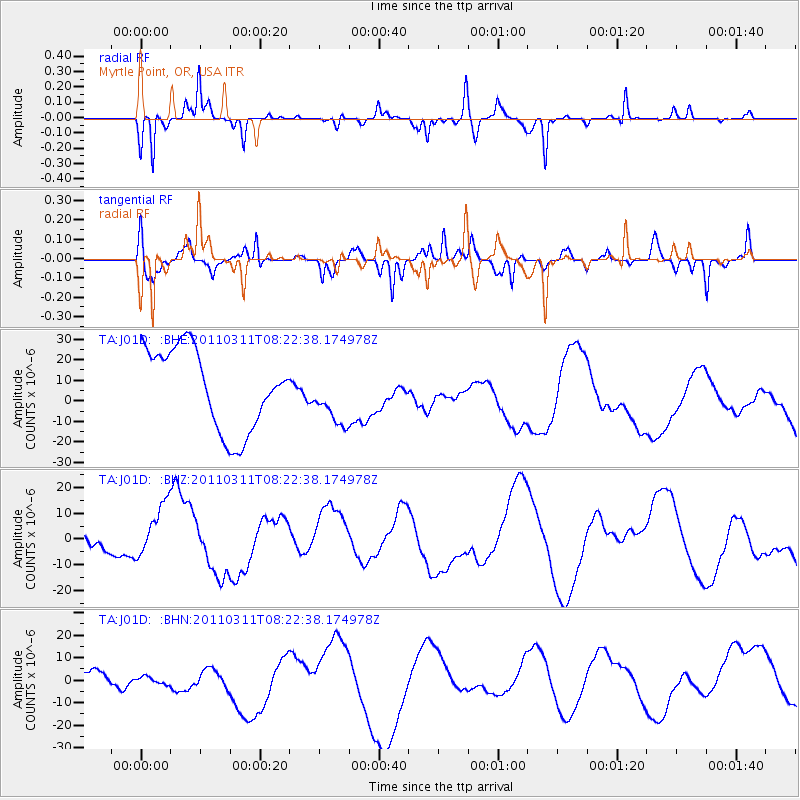
J01D Myrtle Point, OR, USA - Earthquake Result Viewer
*The percent match for this event was below the threshold and hence no stack was calculated.
| Earthquake location: |
Near East Coast Of Honshu, Japan |
| Earthquake latitude/longitude: |
36.6/141.5 |
| Earthquake time(UTC): |
2011/03/11 (070) 08:12:07 GMT |
| Earthquake Depth: |
40 km |
| Earthquake Magnitude: |
6.2 MB |
| Earthquake Catalog/Contributor: |
WHDF/NEIC |
|
| Network: |
TA USArray Transportable Network (new EarthScope stations) |
| Station: |
J01D Myrtle Point, OR, USA |
| Lat/Lon: |
43.16 N/123.93 W |
| Elevation: |
131 m |
|
| Distance: |
69.1 deg |
| Az: |
51.345 deg |
| Baz: |
300.775 deg |
| Ray Param: |
$rayparam |
*The percent match for this event was below the threshold and hence was not used in the summary stack. |
|
| Radial Match: |
54.36872 % |
| Radial Bump: |
210 |
| Transverse Match: |
59.1014 % |
| Transverse Bump: |
308 |
| SOD ConfigId: |
356183 |
| Insert Time: |
2011-08-13 06:04:10.934 +0000 |
| GWidth: |
2.5 |
| Max Bumps: |
400 |
| Tol: |
0.001 |
|
Signal To Noise
| Channel | StoN | STA | LTA |
| TA:J01D: :BHZ:20110311T08:22:38.174978Z | 0.9622536 | 1.8168326E-5 | 1.8881017E-5 |
| TA:J01D: :BHN:20110311T08:22:38.174978Z | 0.13676755 | 1.598112E-6 | 1.1684877E-5 |
| TA:J01D: :BHE:20110311T08:22:38.174978Z | 0.6936143 | 1.3570031E-5 | 1.9564231E-5 |
| Arrivals |
| Ps | |
| PpPs | |
| PsPs/PpSs | |


