You are here: Home > Network List > TA - USArray Transportable Network (new EarthScope stations) Stations List
> Station O03D Paynes Creek, CA, USA > Earthquake Result Viewer
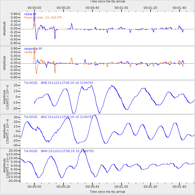
O03D Paynes Creek, CA, USA - Earthquake Result Viewer
*The percent match for this event was below the threshold and hence no stack was calculated.
| Earthquake location: |
Off East Coast Of Honshu, Japan |
| Earthquake latitude/longitude: |
37.0/144.5 |
| Earthquake time(UTC): |
2011/03/11 (070) 08:15:41 GMT |
| Earthquake Depth: |
41 km |
| Earthquake Magnitude: |
6.1 MB |
| Earthquake Catalog/Contributor: |
WHDF/NEIC |
|
| Network: |
TA USArray Transportable Network (new EarthScope stations) |
| Station: |
O03D Paynes Creek, CA, USA |
| Lat/Lon: |
40.29 N/121.80 W |
| Elevation: |
968 m |
|
| Distance: |
69.7 deg |
| Az: |
54.49 deg |
| Baz: |
301.626 deg |
| Ray Param: |
$rayparam |
*The percent match for this event was below the threshold and hence was not used in the summary stack. |
|
| Radial Match: |
66.34977 % |
| Radial Bump: |
400 |
| Transverse Match: |
46.65412 % |
| Transverse Bump: |
227 |
| SOD ConfigId: |
356183 |
| Insert Time: |
2011-08-13 07:36:13.698 +0000 |
| GWidth: |
2.5 |
| Max Bumps: |
400 |
| Tol: |
0.001 |
|
Signal To Noise
| Channel | StoN | STA | LTA |
| TA:O03D: :BHZ:20110311T08:26:16.324976Z | 0.67339236 | 9.452849E-6 | 1.4037654E-5 |
| TA:O03D: :BHN:20110311T08:26:16.324976Z | 1.7889576 | 1.4453395E-5 | 8.079227E-6 |
| TA:O03D: :BHE:20110311T08:26:16.324976Z | 1.5363716 | 1.2891097E-5 | 8.390612E-6 |
| Arrivals |
| Ps | |
| PpPs | |
| PsPs/PpSs | |


