You are here: Home > Network List > TA - USArray Transportable Network (new EarthScope stations) Stations List
> Station O56A Blue Knob State Park, Imler, PA, USA > Earthquake Result Viewer
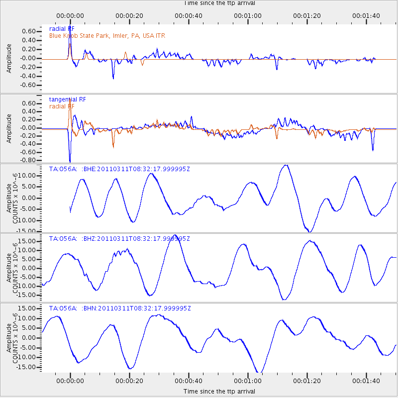
O56A Blue Knob State Park, Imler, PA, USA - Earthquake Result Viewer
*The percent match for this event was below the threshold and hence no stack was calculated.
| Earthquake location: |
Near East Coast Of Honshu, Japan |
| Earthquake latitude/longitude: |
36.2/141.6 |
| Earthquake time(UTC): |
2011/03/11 (070) 08:19:24 GMT |
| Earthquake Depth: |
6.8 km |
| Earthquake Magnitude: |
6.5 MB |
| Earthquake Catalog/Contributor: |
WHDF/NEIC |
|
| Network: |
TA USArray Transportable Network (new EarthScope stations) |
| Station: |
O56A Blue Knob State Park, Imler, PA, USA |
| Lat/Lon: |
40.27 N/78.57 W |
| Elevation: |
684 m |
|
| Distance: |
95.5 deg |
| Az: |
29.696 deg |
| Baz: |
328.406 deg |
| Ray Param: |
$rayparam |
*The percent match for this event was below the threshold and hence was not used in the summary stack. |
|
| Radial Match: |
70.61954 % |
| Radial Bump: |
400 |
| Transverse Match: |
65.282684 % |
| Transverse Bump: |
400 |
| SOD ConfigId: |
356183 |
| Insert Time: |
2011-08-13 09:20:49.418 +0000 |
| GWidth: |
2.5 |
| Max Bumps: |
400 |
| Tol: |
0.001 |
|
Signal To Noise
| Channel | StoN | STA | LTA |
| TA:O56A: :BHZ:20110311T08:32:17.999995Z | 0.95344585 | 7.65216E-6 | 8.025794E-6 |
| TA:O56A: :BHN:20110311T08:32:17.999995Z | 1.3305283 | 1.0645585E-5 | 8.00102E-6 |
| TA:O56A: :BHE:20110311T08:32:17.999995Z | 0.8233178 | 5.0287103E-6 | 6.107861E-6 |
| Arrivals |
| Ps | |
| PpPs | |
| PsPs/PpSs | |


