You are here: Home > Network List > TA - USArray Transportable Network (new EarthScope stations) Stations List
> Station X39A Fountain Ranch, Mena, AR, USA > Earthquake Result Viewer
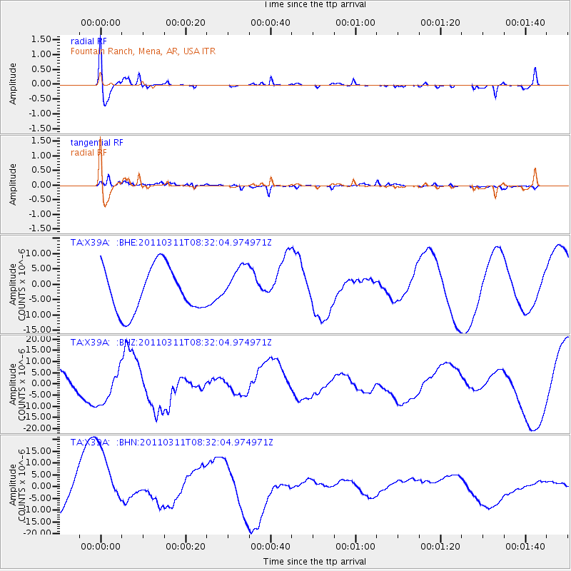
X39A Fountain Ranch, Mena, AR, USA - Earthquake Result Viewer
*The percent match for this event was below the threshold and hence no stack was calculated.
| Earthquake location: |
Near East Coast Of Honshu, Japan |
| Earthquake latitude/longitude: |
36.2/141.6 |
| Earthquake time(UTC): |
2011/03/11 (070) 08:19:24 GMT |
| Earthquake Depth: |
6.8 km |
| Earthquake Magnitude: |
6.5 MB |
| Earthquake Catalog/Contributor: |
WHDF/NEIC |
|
| Network: |
TA USArray Transportable Network (new EarthScope stations) |
| Station: |
X39A Fountain Ranch, Mena, AR, USA |
| Lat/Lon: |
34.51 N/94.11 W |
| Elevation: |
326 m |
|
| Distance: |
92.6 deg |
| Az: |
43.055 deg |
| Baz: |
318.012 deg |
| Ray Param: |
$rayparam |
*The percent match for this event was below the threshold and hence was not used in the summary stack. |
|
| Radial Match: |
49.6173 % |
| Radial Bump: |
400 |
| Transverse Match: |
65.54488 % |
| Transverse Bump: |
341 |
| SOD ConfigId: |
356183 |
| Insert Time: |
2011-08-13 09:23:12.099 +0000 |
| GWidth: |
2.5 |
| Max Bumps: |
400 |
| Tol: |
0.001 |
|
Signal To Noise
| Channel | StoN | STA | LTA |
| TA:X39A: :BHZ:20110311T08:32:04.974971Z | 1.1089067 | 7.949538E-6 | 7.168806E-6 |
| TA:X39A: :BHN:20110311T08:32:04.974971Z | 2.4843338 | 1.5056627E-5 | 6.0606294E-6 |
| TA:X39A: :BHE:20110311T08:32:04.974971Z | 0.89821535 | 6.5007725E-6 | 7.237432E-6 |
| Arrivals |
| Ps | |
| PpPs | |
| PsPs/PpSs | |


