You are here: Home > Network List > US - United States National Seismic Network Stations List
> Station HAWA Hanford, Washington, USA > Earthquake Result Viewer
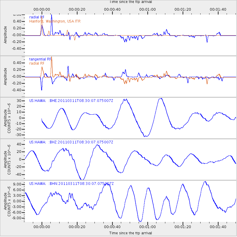
HAWA Hanford, Washington, USA - Earthquake Result Viewer
*The percent match for this event was below the threshold and hence no stack was calculated.
| Earthquake location: |
Near East Coast Of Honshu, Japan |
| Earthquake latitude/longitude: |
36.2/141.6 |
| Earthquake time(UTC): |
2011/03/11 (070) 08:19:24 GMT |
| Earthquake Depth: |
6.8 km |
| Earthquake Magnitude: |
6.5 MB |
| Earthquake Catalog/Contributor: |
WHDF/NEIC |
|
| Network: |
US United States National Seismic Network |
| Station: |
HAWA Hanford, Washington, USA |
| Lat/Lon: |
46.39 N/119.53 W |
| Elevation: |
364 m |
|
| Distance: |
70.3 deg |
| Az: |
46.584 deg |
| Baz: |
301.872 deg |
| Ray Param: |
$rayparam |
*The percent match for this event was below the threshold and hence was not used in the summary stack. |
|
| Radial Match: |
72.21974 % |
| Radial Bump: |
323 |
| Transverse Match: |
85.65487 % |
| Transverse Bump: |
400 |
| SOD ConfigId: |
356183 |
| Insert Time: |
2011-08-13 09:29:10.285 +0000 |
| GWidth: |
2.5 |
| Max Bumps: |
400 |
| Tol: |
0.001 |
|
Signal To Noise
| Channel | StoN | STA | LTA |
| US:HAWA: :BHZ:20110311T08:30:07.075007Z | 2.7262158 | 2.6632244E-5 | 9.768942E-6 |
| US:HAWA: :BHN:20110311T08:30:07.075007Z | 0.56499773 | 2.6489367E-6 | 4.688402E-6 |
| US:HAWA: :BHE:20110311T08:30:07.075007Z | 0.65528333 | 7.89459E-6 | 1.2047599E-5 |
| Arrivals |
| Ps | |
| PpPs | |
| PsPs/PpSs | |


