You are here: Home > Network List > TA - USArray Transportable Network (new EarthScope stations) Stations List
> Station D35A Remer, MN, USA > Earthquake Result Viewer
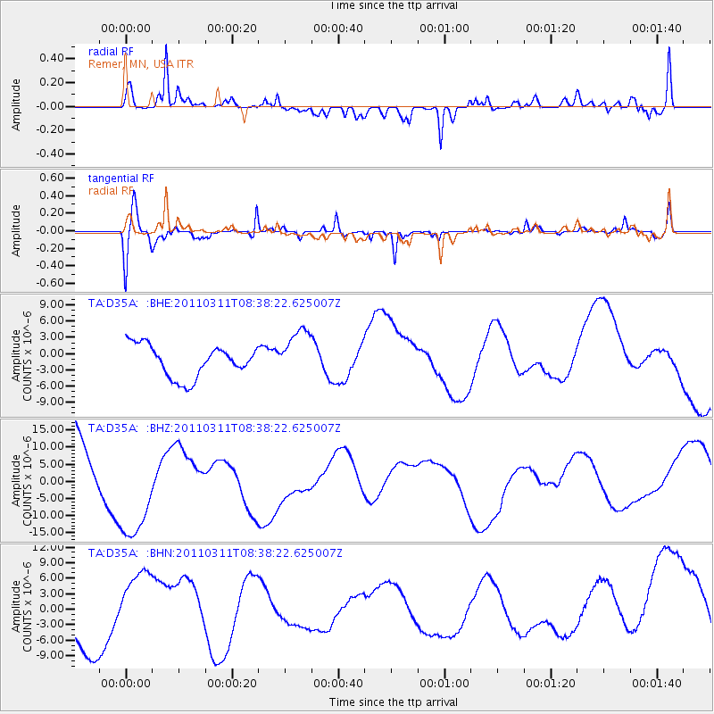
D35A Remer, MN, USA - Earthquake Result Viewer
*The percent match for this event was below the threshold and hence no stack was calculated.
| Earthquake location: |
Off East Coast Of Honshu, Japan |
| Earthquake latitude/longitude: |
37.4/143.0 |
| Earthquake time(UTC): |
2011/03/11 (070) 08:26:36 GMT |
| Earthquake Depth: |
17 km |
| Earthquake Magnitude: |
6.1 MB |
| Earthquake Catalog/Contributor: |
WHDF/NEIC |
|
| Network: |
TA USArray Transportable Network (new EarthScope stations) |
| Station: |
D35A Remer, MN, USA |
| Lat/Lon: |
47.08 N/94.05 W |
| Elevation: |
427 m |
|
| Distance: |
81.7 deg |
| Az: |
35.433 deg |
| Baz: |
317.477 deg |
| Ray Param: |
$rayparam |
*The percent match for this event was below the threshold and hence was not used in the summary stack. |
|
| Radial Match: |
52.120525 % |
| Radial Bump: |
400 |
| Transverse Match: |
54.55164 % |
| Transverse Bump: |
400 |
| SOD ConfigId: |
356183 |
| Insert Time: |
2011-08-13 11:18:17.285 +0000 |
| GWidth: |
2.5 |
| Max Bumps: |
400 |
| Tol: |
0.001 |
|
Signal To Noise
| Channel | StoN | STA | LTA |
| TA:D35A: :BHZ:20110311T08:38:22.625007Z | 1.7743934 | 1.4541705E-5 | 8.19531E-6 |
| TA:D35A: :BHN:20110311T08:38:22.625007Z | 1.3493874 | 8.389956E-6 | 6.2176027E-6 |
| TA:D35A: :BHE:20110311T08:38:22.625007Z | 1.5638177 | 4.595255E-6 | 2.9384853E-6 |
| Arrivals |
| Ps | |
| PpPs | |
| PsPs/PpSs | |


