You are here: Home > Network List > TA - USArray Transportable Network (new EarthScope stations) Stations List
> Station MDND Maddock, ND, USA > Earthquake Result Viewer
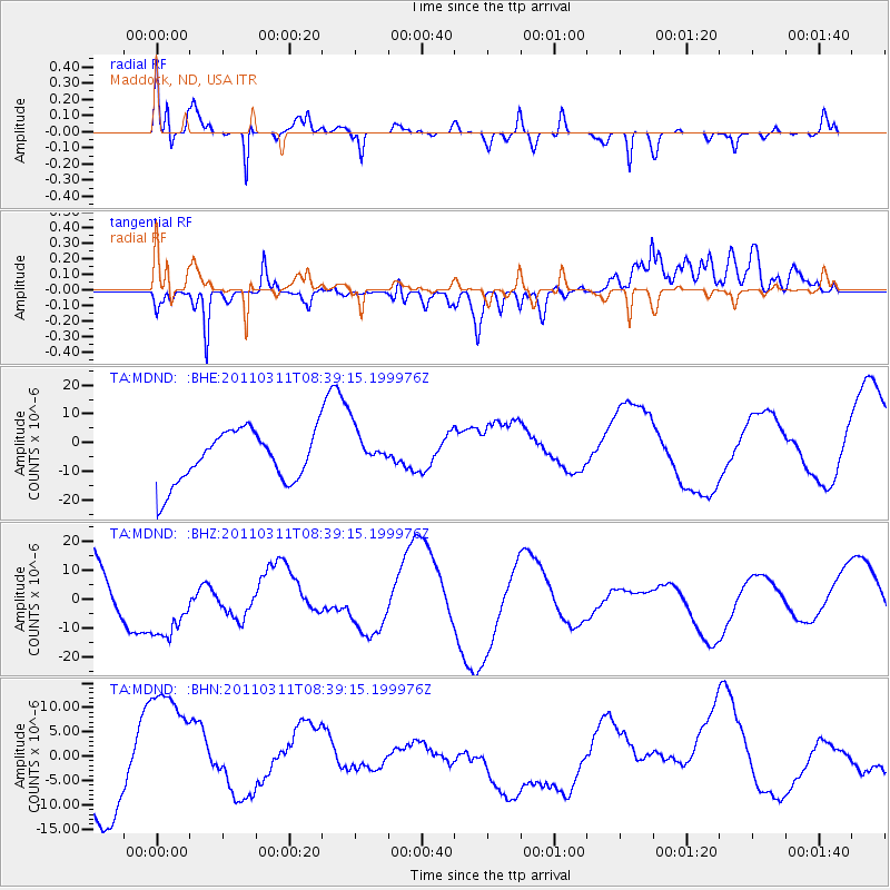
MDND Maddock, ND, USA - Earthquake Result Viewer
*The percent match for this event was below the threshold and hence no stack was calculated.
| Earthquake location: |
Near East Coast Of Honshu, Japan |
| Earthquake latitude/longitude: |
38.0/142.7 |
| Earthquake time(UTC): |
2011/03/11 (070) 08:27:51 GMT |
| Earthquake Depth: |
43 km |
| Earthquake Magnitude: |
6.0 MB |
| Earthquake Catalog/Contributor: |
WHDF/NEIC |
|
| Network: |
TA USArray Transportable Network (new EarthScope stations) |
| Station: |
MDND Maddock, ND, USA |
| Lat/Lon: |
47.85 N/99.60 W |
| Elevation: |
479 m |
|
| Distance: |
78.1 deg |
| Az: |
37.531 deg |
| Baz: |
314.412 deg |
| Ray Param: |
$rayparam |
*The percent match for this event was below the threshold and hence was not used in the summary stack. |
|
| Radial Match: |
78.992935 % |
| Radial Bump: |
400 |
| Transverse Match: |
54.904198 % |
| Transverse Bump: |
400 |
| SOD ConfigId: |
356183 |
| Insert Time: |
2011-08-13 12:45:05.970 +0000 |
| GWidth: |
2.5 |
| Max Bumps: |
400 |
| Tol: |
0.001 |
|
Signal To Noise
| Channel | StoN | STA | LTA |
| TA:MDND: :BHZ:20110311T08:39:15.199976Z | 1.2152026 | 1.2669799E-5 | 1.042608E-5 |
| TA:MDND: :BHN:20110311T08:39:15.199976Z | 2.4879165 | 1.546579E-5 | 6.2163626E-6 |
| TA:MDND: :BHE:20110311T08:39:15.199976Z | 0.8317076 | 7.3818796E-6 | 8.8755705E-6 |
| Arrivals |
| Ps | |
| PpPs | |
| PsPs/PpSs | |


