You are here: Home > Network List > TA - USArray Transportable Network (new EarthScope stations) Stations List
> Station S29A Ulysses, KS, USA > Earthquake Result Viewer
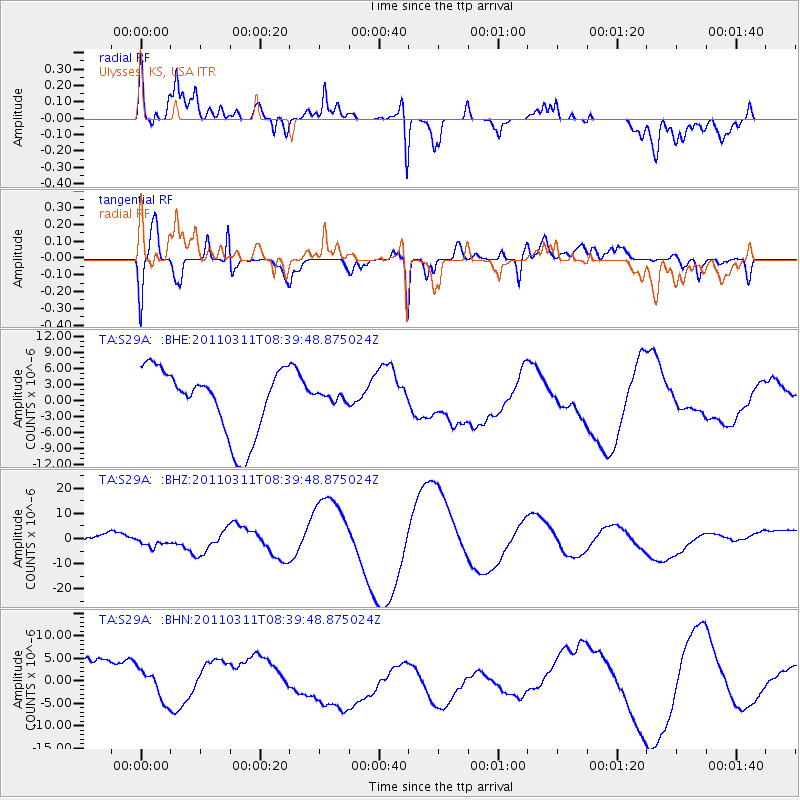
S29A Ulysses, KS, USA - Earthquake Result Viewer
*The percent match for this event was below the threshold and hence no stack was calculated.
| Earthquake location: |
Near East Coast Of Honshu, Japan |
| Earthquake latitude/longitude: |
38.0/142.7 |
| Earthquake time(UTC): |
2011/03/11 (070) 08:27:51 GMT |
| Earthquake Depth: |
43 km |
| Earthquake Magnitude: |
6.0 MB |
| Earthquake Catalog/Contributor: |
WHDF/NEIC |
|
| Network: |
TA USArray Transportable Network (new EarthScope stations) |
| Station: |
S29A Ulysses, KS, USA |
| Lat/Lon: |
37.62 N/101.12 W |
| Elevation: |
931 m |
|
| Distance: |
84.5 deg |
| Az: |
45.692 deg |
| Baz: |
314.619 deg |
| Ray Param: |
$rayparam |
*The percent match for this event was below the threshold and hence was not used in the summary stack. |
|
| Radial Match: |
69.52768 % |
| Radial Bump: |
400 |
| Transverse Match: |
66.19875 % |
| Transverse Bump: |
400 |
| SOD ConfigId: |
356183 |
| Insert Time: |
2011-08-13 12:46:52.169 +0000 |
| GWidth: |
2.5 |
| Max Bumps: |
400 |
| Tol: |
0.001 |
|
Signal To Noise
| Channel | StoN | STA | LTA |
| TA:S29A: :BHZ:20110311T08:39:48.875024Z | 0.9946262 | 2.5784443E-6 | 2.5923753E-6 |
| TA:S29A: :BHN:20110311T08:39:48.875024Z | 0.640813 | 3.8842845E-6 | 6.061495E-6 |
| TA:S29A: :BHE:20110311T08:39:48.875024Z | 0.13897972 | 8.674613E-7 | 6.2416398E-6 |
| Arrivals |
| Ps | |
| PpPs | |
| PsPs/PpSs | |


