You are here: Home > Network List > TA - USArray Transportable Network (new EarthScope stations) Stations List
> Station P30A Selden, KS, USA > Earthquake Result Viewer
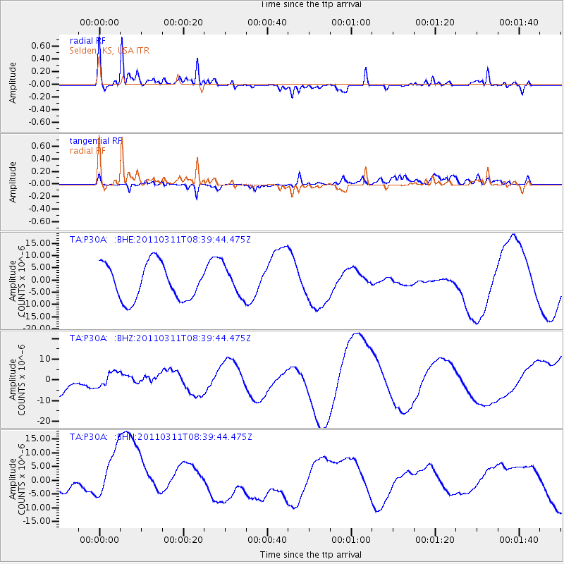
P30A Selden, KS, USA - Earthquake Result Viewer
*The percent match for this event was below the threshold and hence no stack was calculated.
| Earthquake location: |
Near East Coast Of Honshu, Japan |
| Earthquake latitude/longitude: |
38.0/142.7 |
| Earthquake time(UTC): |
2011/03/11 (070) 08:27:51 GMT |
| Earthquake Depth: |
43 km |
| Earthquake Magnitude: |
6.0 MB |
| Earthquake Catalog/Contributor: |
WHDF/NEIC |
|
| Network: |
TA USArray Transportable Network (new EarthScope stations) |
| Station: |
P30A Selden, KS, USA |
| Lat/Lon: |
39.54 N/100.25 W |
| Elevation: |
788 m |
|
| Distance: |
83.6 deg |
| Az: |
43.838 deg |
| Baz: |
314.969 deg |
| Ray Param: |
$rayparam |
*The percent match for this event was below the threshold and hence was not used in the summary stack. |
|
| Radial Match: |
65.86975 % |
| Radial Bump: |
323 |
| Transverse Match: |
54.466747 % |
| Transverse Bump: |
400 |
| SOD ConfigId: |
356183 |
| Insert Time: |
2011-08-13 12:48:22.269 +0000 |
| GWidth: |
2.5 |
| Max Bumps: |
400 |
| Tol: |
0.001 |
|
Signal To Noise
| Channel | StoN | STA | LTA |
| TA:P30A: :BHZ:20110311T08:39:44.475Z | 0.6202395 | 3.5211356E-6 | 5.6770577E-6 |
| TA:P30A: :BHN:20110311T08:39:44.475Z | 2.843469 | 1.0474819E-5 | 3.683817E-6 |
| TA:P30A: :BHE:20110311T08:39:44.475Z | 0.80409455 | 5.8924948E-6 | 7.328112E-6 |
| Arrivals |
| Ps | |
| PpPs | |
| PsPs/PpSs | |


