You are here: Home > Network List > TA - USArray Transportable Network (new EarthScope stations) Stations List
> Station M35A Neola, IA, USA > Earthquake Result Viewer
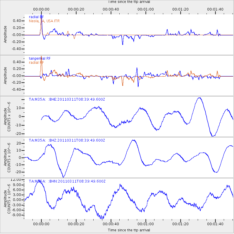
M35A Neola, IA, USA - Earthquake Result Viewer
*The percent match for this event was below the threshold and hence no stack was calculated.
| Earthquake location: |
Near East Coast Of Honshu, Japan |
| Earthquake latitude/longitude: |
38.0/142.7 |
| Earthquake time(UTC): |
2011/03/11 (070) 08:27:51 GMT |
| Earthquake Depth: |
43 km |
| Earthquake Magnitude: |
6.0 MB |
| Earthquake Catalog/Contributor: |
WHDF/NEIC |
|
| Network: |
TA USArray Transportable Network (new EarthScope stations) |
| Station: |
M35A Neola, IA, USA |
| Lat/Lon: |
41.47 N/95.69 W |
| Elevation: |
363 m |
|
| Distance: |
84.7 deg |
| Az: |
39.984 deg |
| Baz: |
317.522 deg |
| Ray Param: |
$rayparam |
*The percent match for this event was below the threshold and hence was not used in the summary stack. |
|
| Radial Match: |
69.630974 % |
| Radial Bump: |
400 |
| Transverse Match: |
58.753 % |
| Transverse Bump: |
363 |
| SOD ConfigId: |
356183 |
| Insert Time: |
2011-08-13 13:13:45.536 +0000 |
| GWidth: |
2.5 |
| Max Bumps: |
400 |
| Tol: |
0.001 |
|
Signal To Noise
| Channel | StoN | STA | LTA |
| TA:M35A: :BHZ:20110311T08:39:49.600Z | 1.1196353 | 1.142492E-5 | 1.0204143E-5 |
| TA:M35A: :BHN:20110311T08:39:49.600Z | 2.876263 | 1.0521803E-5 | 3.658151E-6 |
| TA:M35A: :BHE:20110311T08:39:49.600Z | 2.9106233 | 1.0293336E-5 | 3.5364715E-6 |
| Arrivals |
| Ps | |
| PpPs | |
| PsPs/PpSs | |


