You are here: Home > Network List > TA - USArray Transportable Network (new EarthScope stations) Stations List
> Station H34A Spellman Lake, Hanley Falls, MN, USA > Earthquake Result Viewer
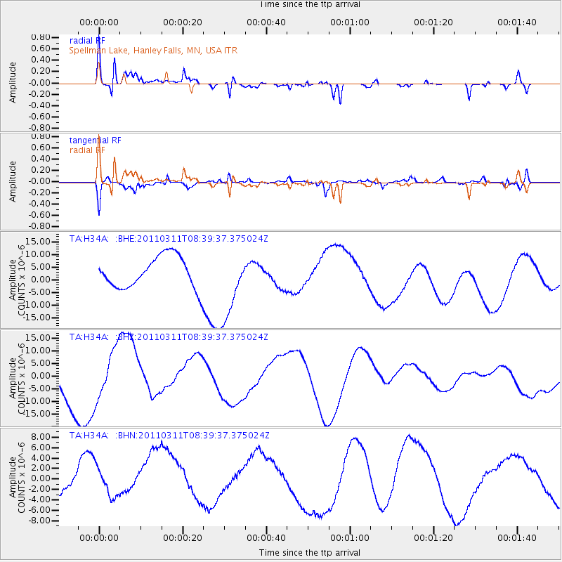
H34A Spellman Lake, Hanley Falls, MN, USA - Earthquake Result Viewer
*The percent match for this event was below the threshold and hence no stack was calculated.
| Earthquake location: |
Near East Coast Of Honshu, Japan |
| Earthquake latitude/longitude: |
38.0/142.7 |
| Earthquake time(UTC): |
2011/03/11 (070) 08:27:51 GMT |
| Earthquake Depth: |
43 km |
| Earthquake Magnitude: |
6.0 MB |
| Earthquake Catalog/Contributor: |
WHDF/NEIC |
|
| Network: |
TA USArray Transportable Network (new EarthScope stations) |
| Station: |
H34A Spellman Lake, Hanley Falls, MN, USA |
| Lat/Lon: |
44.67 N/95.78 W |
| Elevation: |
329 m |
|
| Distance: |
82.3 deg |
| Az: |
37.848 deg |
| Baz: |
317.223 deg |
| Ray Param: |
$rayparam |
*The percent match for this event was below the threshold and hence was not used in the summary stack. |
|
| Radial Match: |
75.41929 % |
| Radial Bump: |
400 |
| Transverse Match: |
60.71162 % |
| Transverse Bump: |
400 |
| SOD ConfigId: |
356183 |
| Insert Time: |
2011-08-13 13:15:49.915 +0000 |
| GWidth: |
2.5 |
| Max Bumps: |
400 |
| Tol: |
0.001 |
|
Signal To Noise
| Channel | StoN | STA | LTA |
| TA:H34A: :BHZ:20110311T08:39:37.375024Z | 1.0094568 | 9.329708E-6 | 9.242305E-6 |
| TA:H34A: :BHN:20110311T08:39:37.375024Z | 0.3452433 | 2.5604893E-6 | 7.4164777E-6 |
| TA:H34A: :BHE:20110311T08:39:37.375024Z | 2.172996 | 1.3430061E-5 | 6.180435E-6 |
| Arrivals |
| Ps | |
| PpPs | |
| PsPs/PpSs | |


