You are here: Home > Network List > TA - USArray Transportable Network (new EarthScope stations) Stations List
> Station M36A Felix, Anita, IA, USA > Earthquake Result Viewer
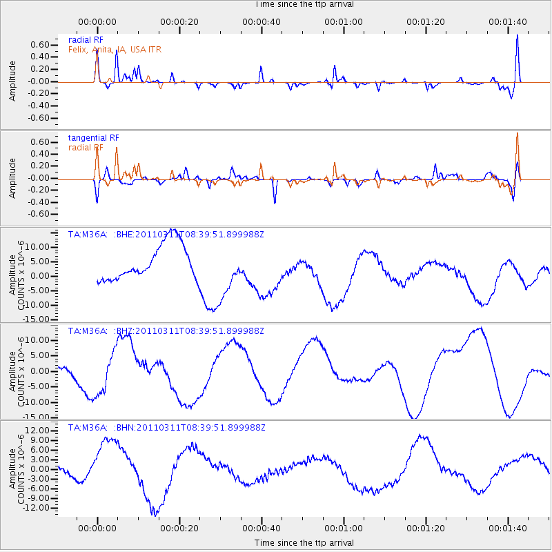
M36A Felix, Anita, IA, USA - Earthquake Result Viewer
*The percent match for this event was below the threshold and hence no stack was calculated.
| Earthquake location: |
Near East Coast Of Honshu, Japan |
| Earthquake latitude/longitude: |
38.0/142.7 |
| Earthquake time(UTC): |
2011/03/11 (070) 08:27:51 GMT |
| Earthquake Depth: |
43 km |
| Earthquake Magnitude: |
6.0 MB |
| Earthquake Catalog/Contributor: |
WHDF/NEIC |
|
| Network: |
TA USArray Transportable Network (new EarthScope stations) |
| Station: |
M36A Felix, Anita, IA, USA |
| Lat/Lon: |
41.45 N/94.80 W |
| Elevation: |
430 m |
|
| Distance: |
85.1 deg |
| Az: |
39.494 deg |
| Baz: |
318.067 deg |
| Ray Param: |
$rayparam |
*The percent match for this event was below the threshold and hence was not used in the summary stack. |
|
| Radial Match: |
74.16217 % |
| Radial Bump: |
400 |
| Transverse Match: |
52.259033 % |
| Transverse Bump: |
302 |
| SOD ConfigId: |
356183 |
| Insert Time: |
2011-08-13 13:25:12.821 +0000 |
| GWidth: |
2.5 |
| Max Bumps: |
400 |
| Tol: |
0.001 |
|
Signal To Noise
| Channel | StoN | STA | LTA |
| TA:M36A: :BHZ:20110311T08:39:51.899988Z | 1.5795763 | 7.011693E-6 | 4.438971E-6 |
| TA:M36A: :BHN:20110311T08:39:51.899988Z | 2.309054 | 9.993114E-6 | 4.3277955E-6 |
| TA:M36A: :BHE:20110311T08:39:51.899988Z | 1.5932827 | 9.675613E-6 | 6.072754E-6 |
| Arrivals |
| Ps | |
| PpPs | |
| PsPs/PpSs | |


